
NORTH AMERICAbyForlani - Zaltieri 1566
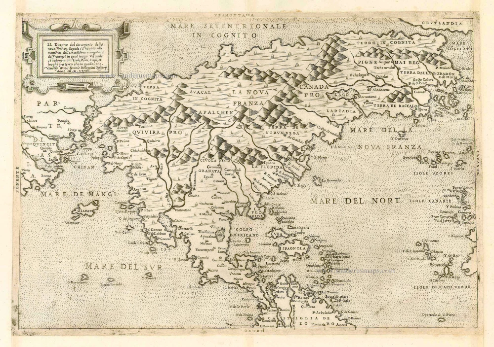
Il Disegno del discoperto della nova Franza, il quale se havuto ultimamente dalla novissima navigatione dè Francesi in quel luogo.
Item Number: 897 Authenticity Guarantee
Category: Antique maps > America > North America
Antique map of North America by Forlani and Zaltieri.
Copper engraving
Size: 28 x 40.5cm (10.9 x 15.8 inches)
Verso: Blank
Condition: Trimmed and remargined for inclusion in an atlas (as usual), small filled hole at upper centrefold, nice copy. References: Burden, #33; Tooley #80; Meurer (Strabo) #191; Bifolco-Ronca, Tav. 56 State 2.
Separate publication.
State 2 of the map with the imprint added below the title Venetijs aenis formis Bolognini Zalterij Anno M.D.LXVI.
One of the most important maps in the history of American Pacific Coast cartography and one of the earliest separate "modern" depictions of North America and the earliest dated map extant showing the separation of the continents of Asia and America.
"This very rare and important map was published and engraved by Paolo Forlani. About the same time as this he published La Descrittione Di Tutto Il Peru, a map which completed the coverage of the American continent. Formerly attributed to Bolognino Zaltieri it was David Woodward's recent study of the works of Paolo Forlani that brought this error to light. Zaltieri is now known to have purchased some copperplates from Forlani sometime around late 1565 or early 1566; he then proceeded to place his own imprint on them. In Giacomo Gastaldi's pamphlet printed by Matteo Pagano in 1561 and entitled La Universale Descrittione del Mondo, he describes a strait between the continents of Asia and America. A map is believed to have been published to accompany this but none has been conclusively identified as such. Almagia's 1939 discovery of a world map by Gastaldi in nine sheets is currently the one ascribed to accompany the pamphlet. Until this find the Forlani-Zaltieri was believed to be the earliest printed representation of the Strait of Anian. Some earlier maps depict the two continents separately (Stobnicza 1512, Solinus 1538, Münster 1540), but none delineates this area with such detail and prominence. As such it has great significance for the cartography of the west coast of North America. It is the earliest available map to depict this strait as Gastaldi's world map survives in just one example, in the British Library. Although it has been claimed that the Bordone is the first map of North America, it was not really drawn from first hand knowledge, and is largely an extension of Asian geography; this one is far more recognisable as such and taken directly from American sources.
Despite the obvious concentration on French interests in the title, the second voyage of Cartier, referred to as novissima navigatione dè Franzesi, is supplemented on the map by the Spanish explorations in the southwest, most notably those of Coronado. The Sierra Nevada mountains are named and Japan is depicted in the middle of the Pacific Ocean. The River Gamas is confused here with the R.S. Lorez (St. Lawrence River), which is mistakenly shown flowing south-east, just a short distance from a large unnamed Lake. Montreal, Ochelaga, is placed on another river, a confusion arising from Ramusi's text. Curiously although the sister map of South America follows the c.1561 world map almost to the letter, this is drawn from Gastaldi's earlier world map of 1546 as well. This is most noticeable with the general outline of the east coast." (Burden).
Related items
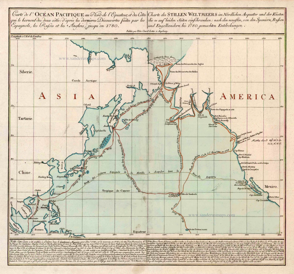
Carte de l'Ocean Pacifique au Nord de l'Equateur, et des Cotes qui le Bornent des Deux Cotes: D'Apres les Dernieres Decouvertes Faites par les Espagnols, les Russes et les Anglois, jusqu'en 1780. 1780
The Northern Pacific Ocean, by T.C. Lotter.
[Item number: 11984]
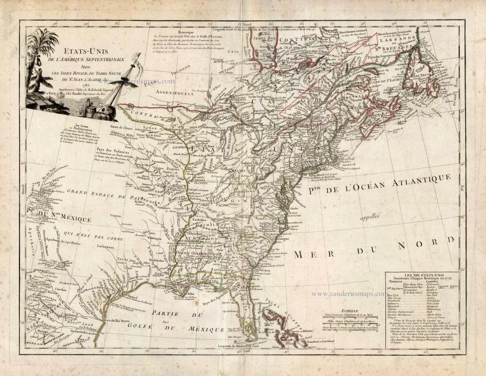
Etats-Unis de l'Amerique Septentrionale avec les Isles Royale, de Terre Neuve de St. Jean, l'Acadie &c. 1786
United States (East) by Boudet A. - de Vaugondy R.
[Item number: 25265]
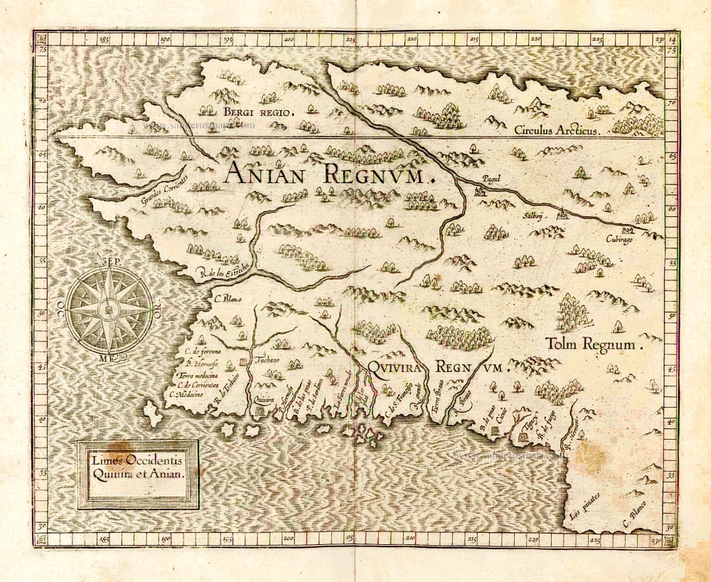
Important map
Limes Occidentis Quivira et Anian. 1607
West coast by Wytfliet, Cornelis van
[Item number: 26513]
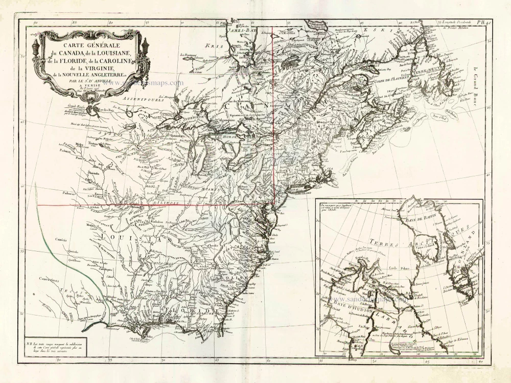
Carte Générale du Canada, de la Louisiane, de la Floride, de la Caroline, de la Virginie, de la Nouvelle Angleterre etc. 1776-79
North America (East), by Paolo Santini.
[Item number: 26980]