
United States (East) by Boudet A. - de Vaugondy R. 1786
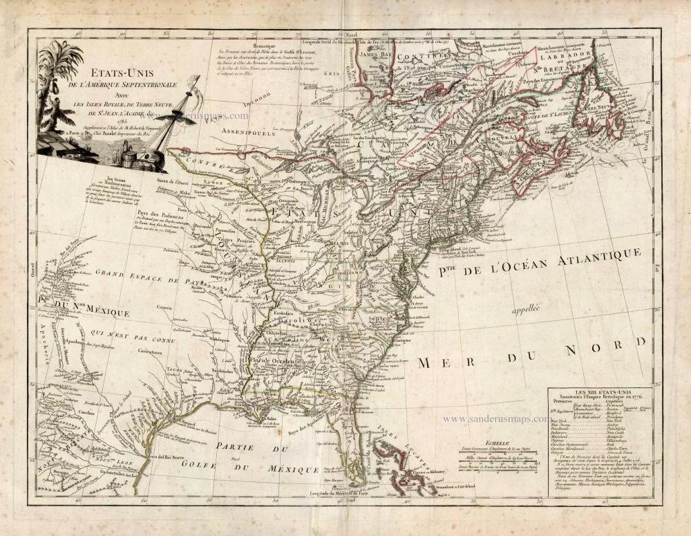
This map gives a list of the thirteen original states, with Vermont and the proposed names of the ten new states provided for in the Jeffersonian ordinance of 1784 - the first map to do so - being Silvania, Michigania, Chesonesus, Arsenistpia, Metropotamia, Illinoia, Saratoga, Washington, Polytamia, and Pelisypia.
The United States is outlined in green, British territories appear in red, and Spanish lands in yellow. The United States extends westward to the Mississippi, beyond which Louisiana has been granted to Spain. So too has Florida and the French colonial seat of New Orleans.
The map is highly detailed, extending to the Rio Grande and including notes on the Sioux Indians and the Country of the Padoucas. Extensive notes throughout, including notes on early explorers such as De Soto and La Sale, Indians, Forts and other points of early interest. Mississippi is marked as the western border, but the map extents till Mexico and naming "Tecas".
The map appeared from 1786 on in the supplement of de Vaugondy's Atlas Universel with the name of Boudet, later with the name of Delamarche.
Gilles and Didier Robert de Vaugondy
Gilles Robert de Vaugondy (1688-1766) and his son Didier Robert de Vaugondy (1723-1786) were leading cartographers in France during the 18th century. They served both as geographer to the king of France. The father, Gilles is also known as ‘Le Sieur’ or ‘Monsieur Robert’. He descended from the Nicolas Sanson family through Sanson's grandson Pierre Moulard-Sanson, from whom he inherited Sanson's cartographic material. After Hubert Jaillot died in 1712, the de Vaugondy's acquired numerous copies of his maps and plates, which formed the basis of their beautiful Atlas Universel (1757).
Their business flourished from 1731 to 1778. They made a substantial contribution to the world of cartography.
Etats-Unis de l'Amerique Septentrionale avec les Isles Royale, de Terre Neuve de St. Jean, l'Acadie &c.
Item Number: 25265 Authenticity Guarantee
Category: Antique maps > America > North America
Old, antique map of United States (East) by Boudet A. - de Vaugondy R.
Date on map: 1785 - first edition, first state.
Copper engraving
Size: 47 x 64cm (18.3 x 25 inches)
Verso: Blank
Condition: Contemporary coloured in outline, light creasing in centre, some light spotting.
Condition Rating: B+
References: Phillips (Atlases), 4292, [111].
From: Robert de Vaugondy G. & D. Atlas Universel, ... Paris, Boudet, 1786. (Phillips, 4292)
This map gives a list of the thirteen original states, with Vermont and the proposed names of the ten new states provided for in the Jeffersonian ordinance of 1784 - the first map to do so - being Silvania, Michigania, Chesonesus, Arsenistpia, Metropotamia, Illinoia, Saratoga, Washington, Polytamia, and Pelisypia.
The United States is outlined in green, British territories appear in red, and Spanish lands in yellow. The United States extends westward to the Mississippi, beyond which Louisiana has been granted to Spain. So too has Florida and the French colonial seat of New Orleans.
The map is highly detailed, extending to the Rio Grande and including notes on the Sioux Indians and the Country of the Padoucas. Extensive notes throughout, including notes on early explorers such as De Soto and La Sale, Indians, Forts and other points of early interest. Mississippi is marked as the western border, but the map extents till Mexico and naming "Tecas".
The map appeared from 1786 on in the supplement of de Vaugondy's Atlas Universel with the name of Boudet, later with the name of Delamarche.
Gilles and Didier Robert de Vaugondy
Gilles Robert de Vaugondy (1688-1766) and his son Didier Robert de Vaugondy (1723-1786) were leading cartographers in France during the 18th century. They served both as geographer to the king of France. The father, Gilles is also known as ‘Le Sieur’ or ‘Monsieur Robert’. He descended from the Nicolas Sanson family through Sanson's grandson Pierre Moulard-Sanson, from whom he inherited Sanson's cartographic material. After Hubert Jaillot died in 1712, the de Vaugondy's acquired numerous copies of his maps and plates, which formed the basis of their beautiful Atlas Universel (1757).
Their business flourished from 1731 to 1778. They made a substantial contribution to the world of cartography.
Related items
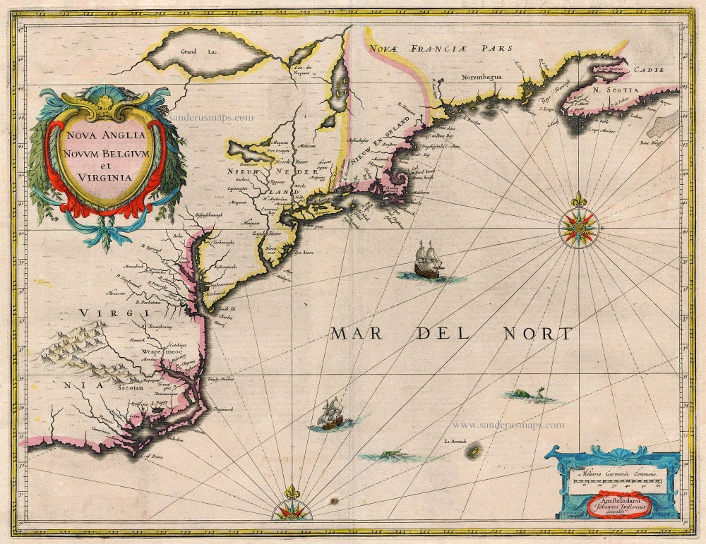
Nova Anglia Novum Belgium et Virginia 1638
United States (Northeast) by Janssonius J.
[Item number: 19011]
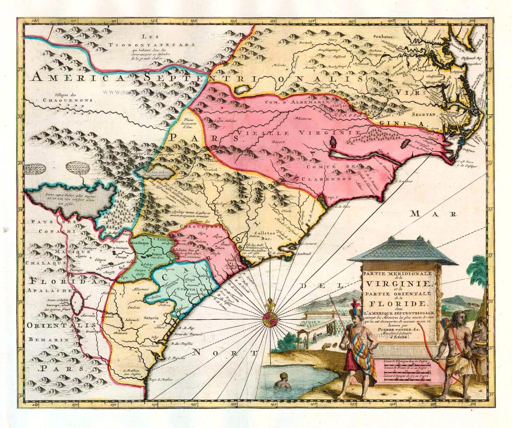
Partie Meridionale de la Virginie, et la Partie Orientale de la Floride dans l'Amerique Septentrionale. 1713
Carolina by Pieter van der Aa.
[Item number: 26137]
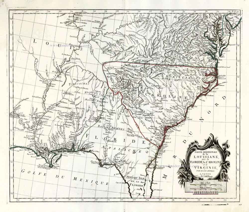
Partie Méridionale de la Louisiane, avec la Floride, la Caroline et la Virginie. 1776-79
The United States (Southeast), by Francesco Santini.
[Item number: 26983]
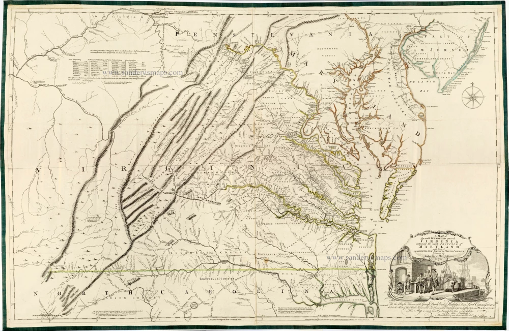
Very important Virginia map.
A Map of the Most Inhabited Part of Virginia Containing the Whole Province of Maryland with Part of Pensilvania, New Jersey and North Carolina. 1775
Joshua Fry & Peter Jefferson
[Item number: 28119]