
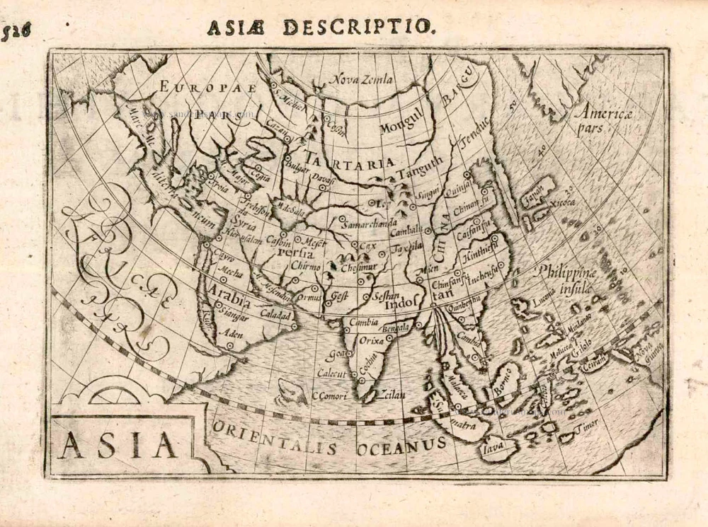
Asia, by A. Thevet. 1581

According to Burden, this edition is scarce; he only located six examples. Compared with the 1575 edition, there are no changes to the map's cartography, only the typography.
André Thevet was a Franciscan monk who travelled extensively in Europe and made a reputed short journey to South America. Upon his return, he records that he sailed along the eastern coast of North America. The experiences he recalls of the New World have attracted much criticism from both his contemporaries and recent historians for their inaccuracy. However, one person seemed impressed, the King of France, Henry III, who bestowed him the honour of Royal Cosmographer.
Asie - [Letterpress title above the map:] Carte des Provinces de la Grande et Petite Asie.
Item Number: 11202 Authenticity Guarantee
Category: Antique maps > Asia > Asia
Old antique map of Asia by A. Thevet.
Title: Asie - [Letterpress title above the map:] Carte des Provinces de la Grande et Petite Asie.
Date of the first edition: 1575.
Date of this map: 1581.
Date on map: 1581.
Woodcut, printed on paper.
Size (not including margins): 350 x 450mm (13.78 x 17.72 inches).
Verso: Blank.
Condition: Two small tears reinforced in lower margin, not affecting the image, else excellent.
Condition Rating: A.
From: Les vrais Portraits et vies des hommes illustres Grecs, Latins, et Payens Receuillis de leur Tableaux, Livres, Medailles antiques, et Modernes Par Andre Thevet Angoumoisin, ... Paris, Par la vefue I. Kervert Et Guillaume Chaudiere, 1584.
According to Burden, this edition is scarce; he only located six examples. Compared with the 1575 edition, there are no changes to the map's cartography, only the typography.
André Thevet was a Franciscan monk who travelled extensively in Europe and made a reputed short journey to South America. Upon his return, he records that he sailed along the eastern coast of North America. The experiences he recalls of the New World have attracted much criticism from both his contemporaries and recent historians for their inaccuracy. However, one person seemed impressed, the King of France, Henry III, who bestowed him the honour of Royal Cosmographer.
Related items
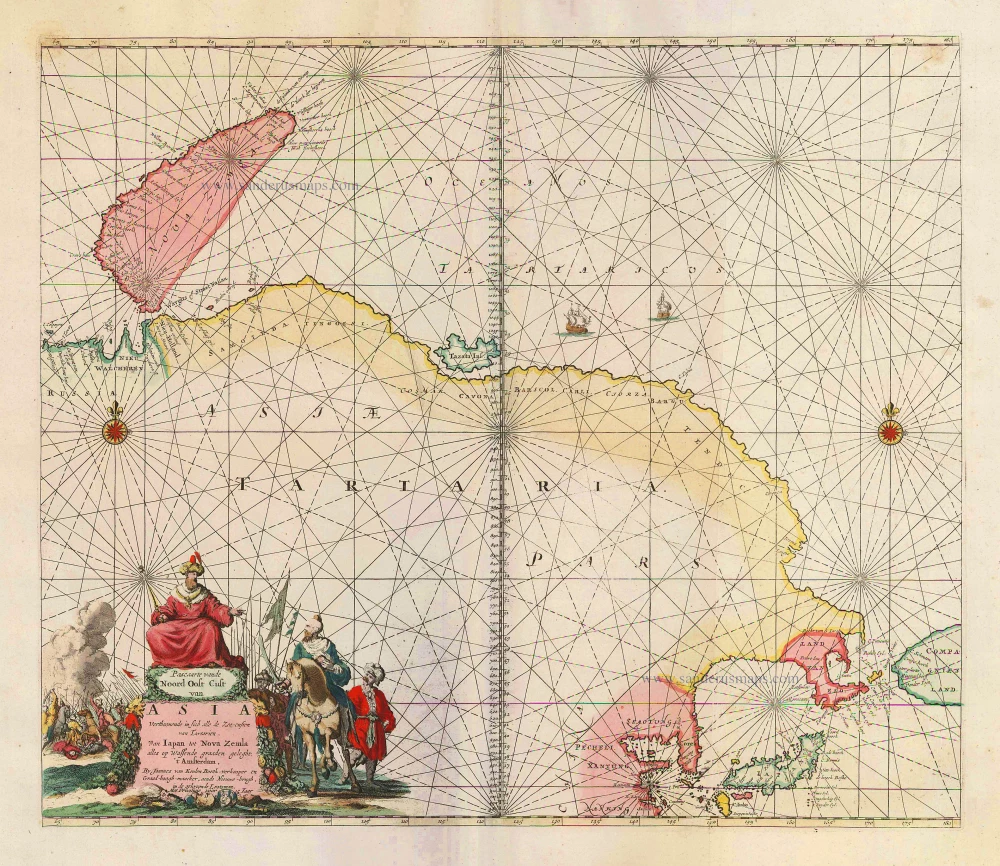
Pascaarte vande Noord Oost Cust van Asia Verthoonende in sich alle de Zee-custen van Tartarien, Van Iapan tot Nova Zemla, ... 1683
Sea chart of Northeast Asia, by J. Van Keulen.
[Item number: 2443]
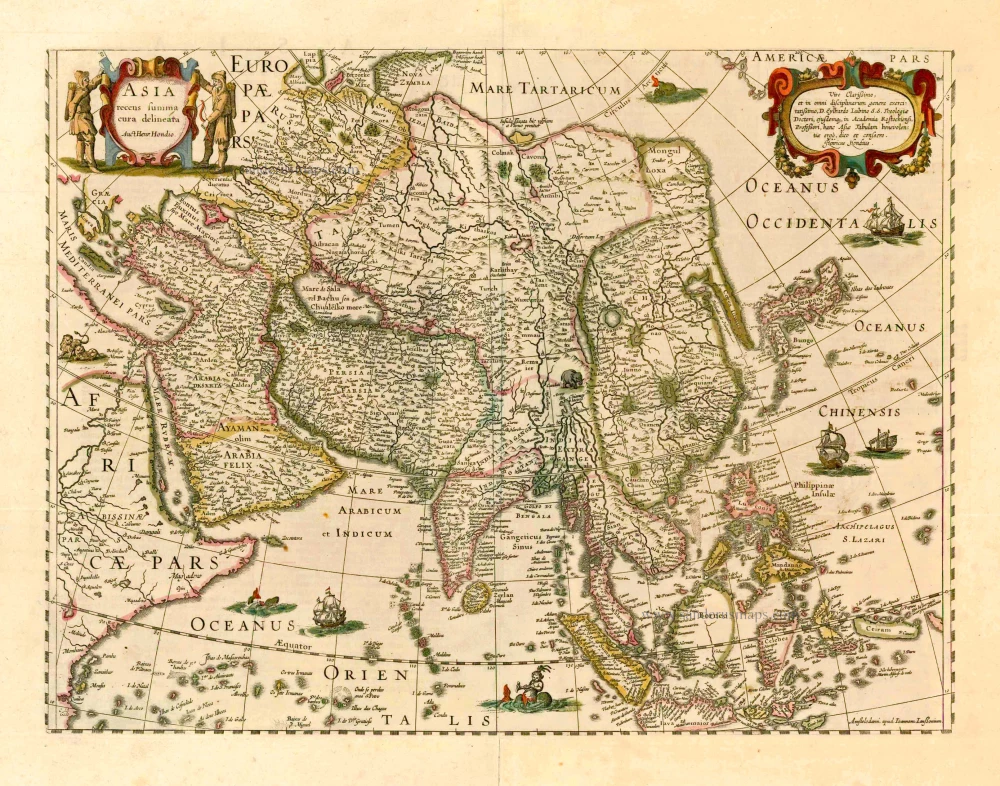
Asia Recens Summa Cura Delineata. 1644-58
Asia, by J. Janssonius
[Item number: 7508]

Accuratissima totius Asiae Tabula. c. 1691-96
Asia, by F. De Wit.
[Item number: 10960]
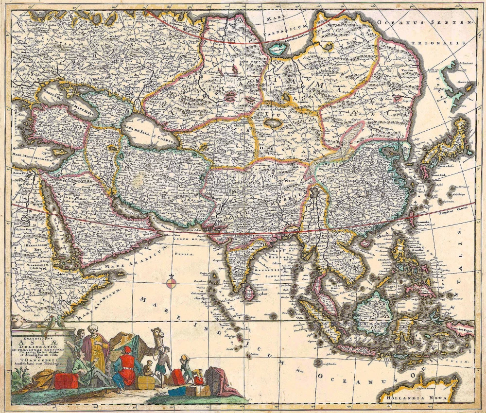
Exactissima Asiae Delineatio in praecipuas regiones Caeterasq Partes divisa. c. 1700
Asia by Th. Danckerts.
[Item number: 11298]
Asia 1602
Asia by Langenes, published by Bertius P.
[Item number: 12518]
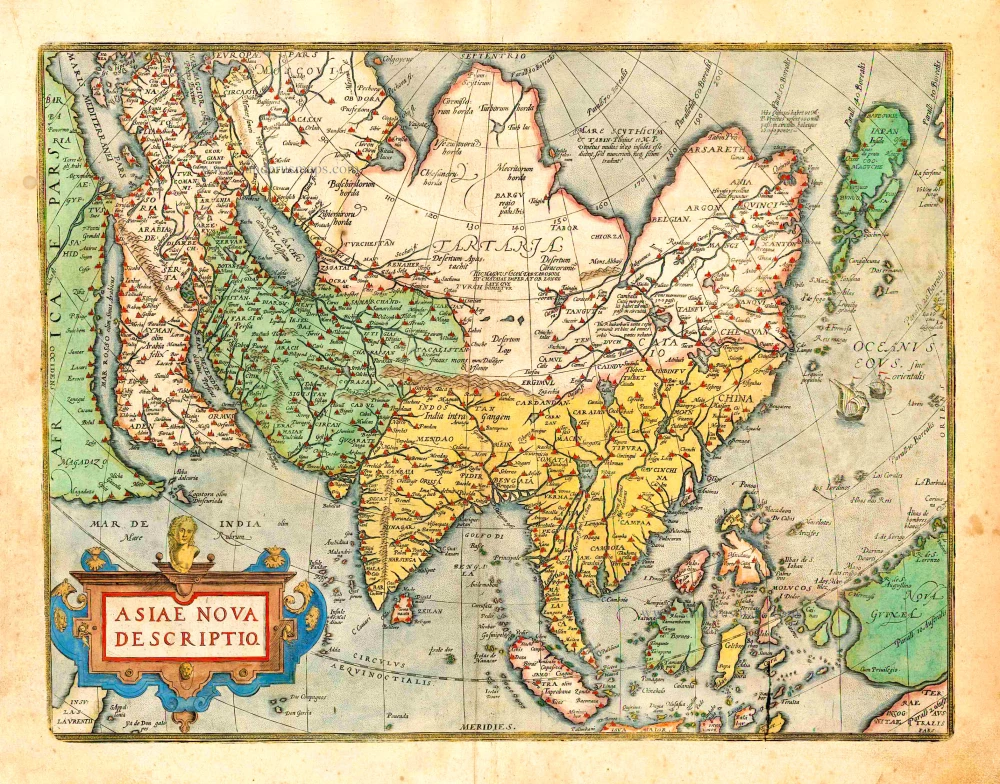
Asiae Nova Descriptio. 1612
Asia, by Abraham Ortelius.
[Item number: 22925]
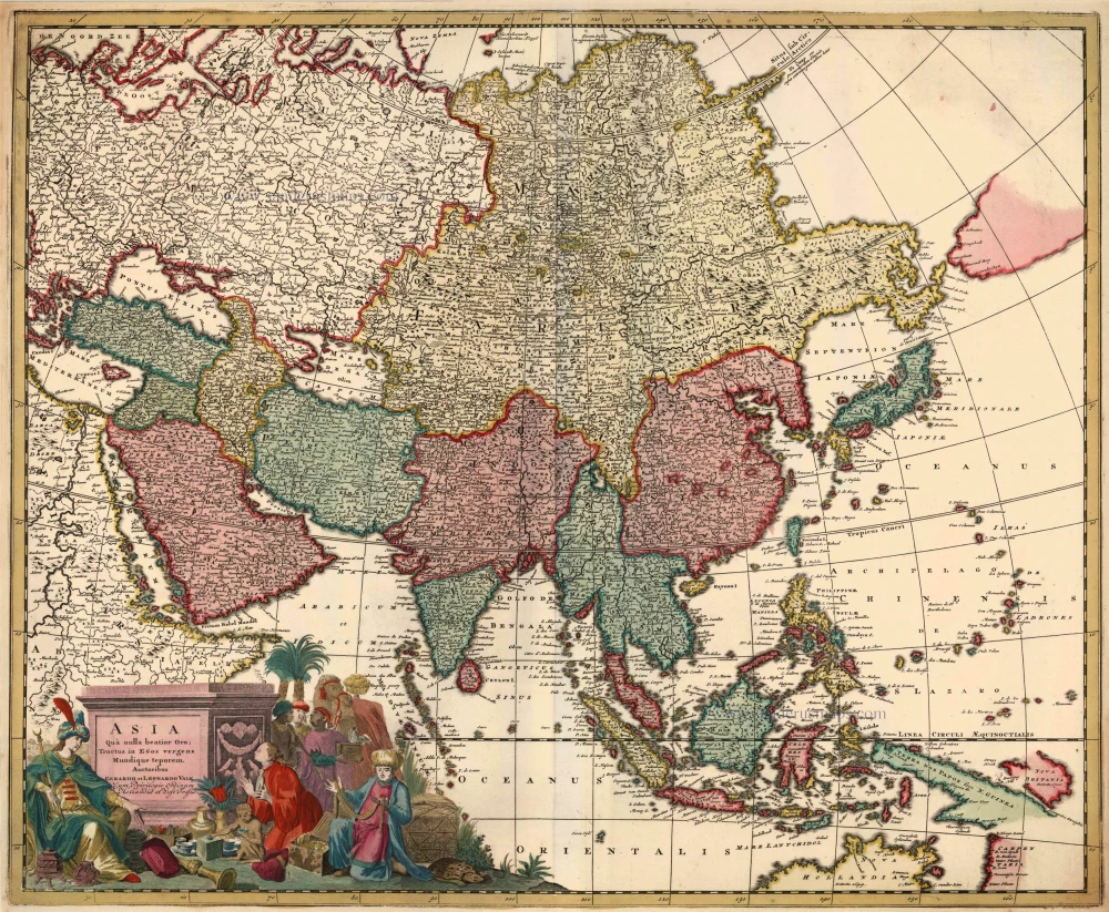
Asia qua Nulla Beatior Ora; Tractus in Eoos Vergens Mundique Teporem. c. 1730.
Asia, by G.& L. Valk.
[Item number: 24538]

Asiae in Tabula Geographica Delineatio. c. 1700
Asia by A.F. Zürner, published by Petrus Schenk.
[Item number: 25842]
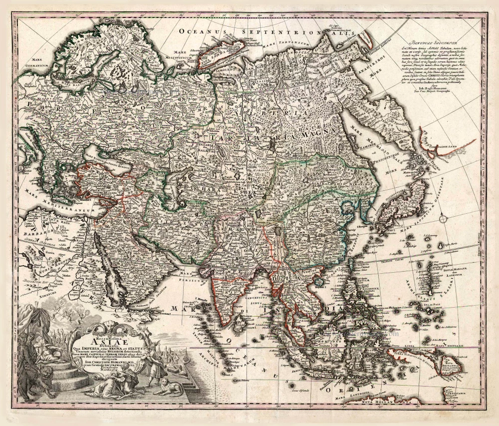
Recentissima Asiae Delineatio qua Imperia, ejus Regna et Status ... 1730-37
Asia, by Homann Johann Christoph.
[Item number: 26733]
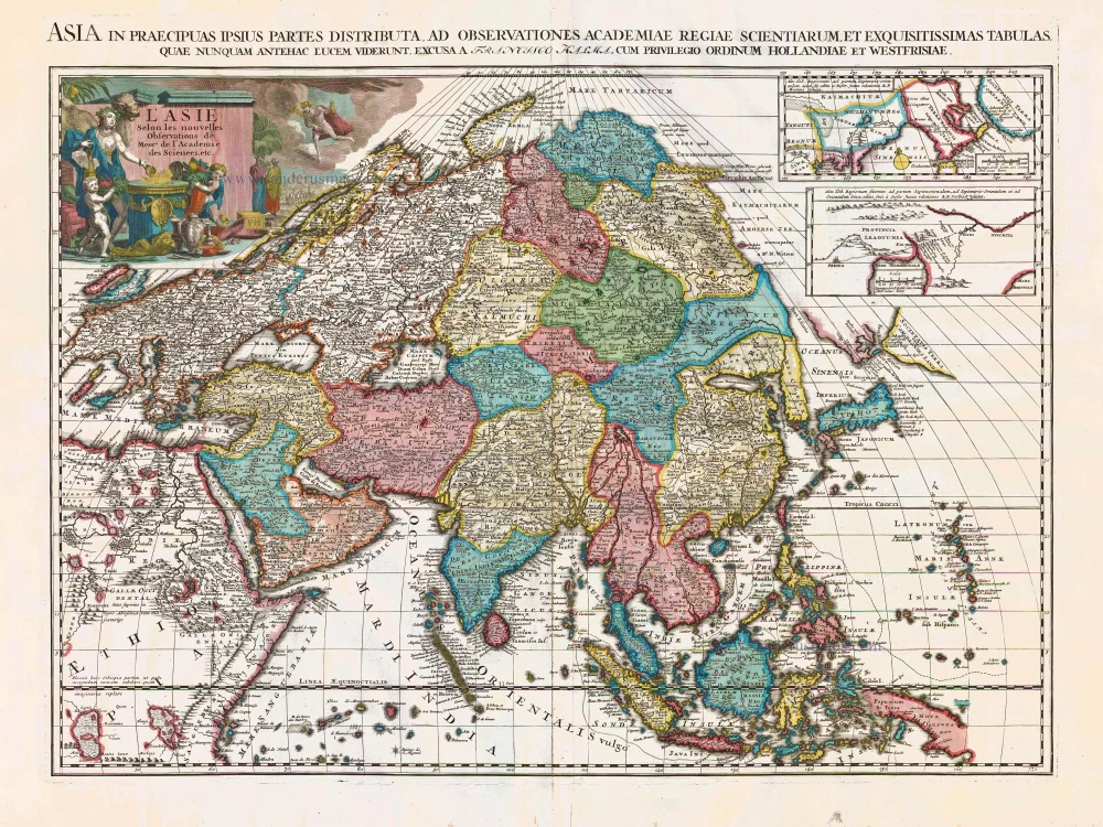
L'Asie Selon les Nouvelles Observations de Messrs. de l'Academie des Sciences, etc. Before 1713
Asia, by François Halma.
[Item number: 27851]
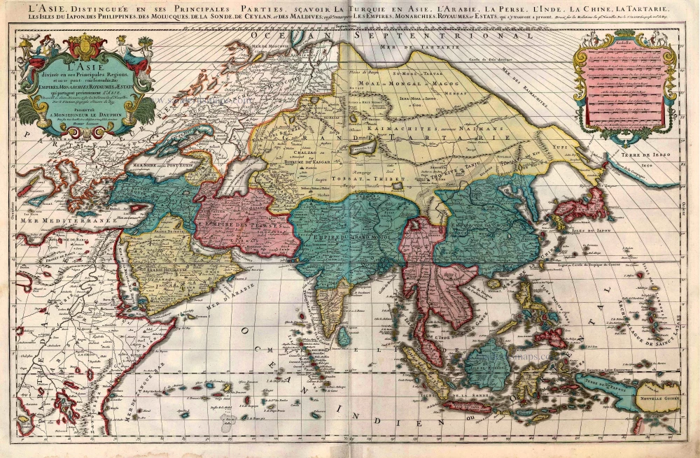
L'Asie divisée en ses Principales Regions, et ou se peut voir l'estendue Des Empites, Monarchies, Royaumes, et Estats qui partagent présentement L'Asie. c. 1705
Asia, by H. Jaillot, published by P. Mortier.
[Item number: 27858]
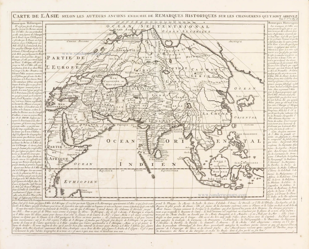
Carte de l'Asie selon les auteurs anciens enrichie de remarques historiques sur les changemens qui y sont arrivez. 1719
Asia, by Zacharias Châtelain.
[Item number: 29387]
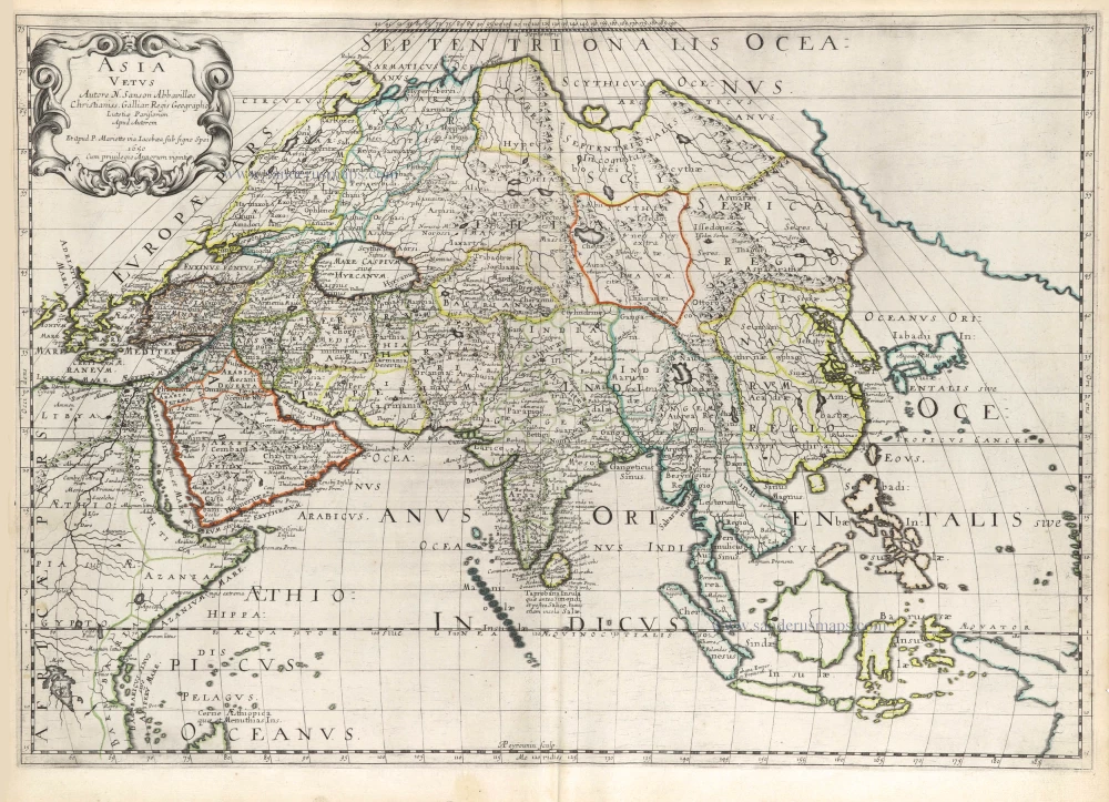
Asia Vetus. 1652
Ancient Asia by Nicolas Sanson.
[Item number: 29687]