
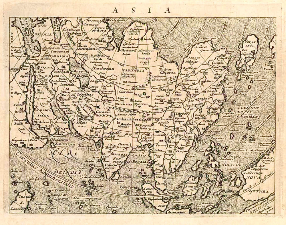
Asia by Barent Langenes & Cornelis Claesz 1598
Barent Langenes ans his Caert-Thresoor
Barent Langenes, a Dutch bookseller and publisher of Middelburg (Zeeland), about whom little is known, was the first printer of the Caert-Thresoor (1598), a small-size atlas with an exciting history. This atlas had many editions in Dutch, Latin, French, and German, later brought out by Cornelis Claesz and Jodocus Hondius. Langenes was involved in the first two Dutch editions.
The Caert-Thresoor, is a collection of maps to which the text was adapted and not the reverse, as in the case with many geographical studies. The most exciting maps are those of the English and the Dutch in arctic waters, searching for the route to China (Northwest Passage). It records the departure of the third fleet of the Dutch in spring 1596, but not the return of survivors of this tragic voyage in August 1597. This atlas sets a new standard for minor atlases. Moreover, it was affordable to the citizens of the lowest income.
The text was rewritten, first by Petrus Bertius and reissued in 1600, secondly in 1609 by Jacobus Viverius. The edition with original basic text continued to be published until 1609, the year of Cornelis Claesz’s death.
Cornelis Claesz.
Printer and bookseller in Amsterdam, 1580-1609. He is famous for publishing maps, pilot guides, and atlases in the beginning period of the development of cartography in the northern Netherlands. He is noted for his co-operation with the cartographer Petrus Plancius and his editions of voyages. After 1590, the works of Lucas Jansz. He published Waghenaer, and in 1599, he acquired the publication rights of Barent Langenes’ Caert-thresoor.
The Caert-Thresoor.
The Caert-Thresoor of 1598 set a new standard for minor atlases. Scholars like Petrus Bertius and Jacobus Viverius edited the text. The small maps are exceptionally well engraved, neat, clear, and elegantly composed. They served many purposes in other books published in Amsterdam. Their contents reflect the level of cartography in Amsterdam at the turn of the century, where up-to-date information on newly discovered regions was readily available. The Caert-Thresoor is a collection of maps to which the text was adapted and not the other way around, as is the case with many geographical studies.
The first edition was published in 1598 by Barent Langenes, a bookseller and publisher in Middelburg.
The book was reissued under the title P. Bertii Tabularum Geographicarum Libri quatuor, in 1600. Bertius recomposed the contents, following Ptolemy's arrangement. Secondly, in 1609, Jacobus Viverius wrote an entirely revised Dutch text, published under the title Handboeck of Cort Begrijp des Caerten. In or after 1609, the year of Cornelis Claesz.'s death, a French edition appeared, printed by Matthaeus Becker for Hendrik Laurensz., the successor of Cornelis Claesz. Finally, an entirely new small atlas was created in 1616 by Jodocus Hondius Jr. All the maps were re-made, and the text by Bertius was revised.
The original maps from the Caert-Thresoor were used to illustrate many of the books on voyages and geography published in Amsterdam in 1596-1600. (Van der Krogt)
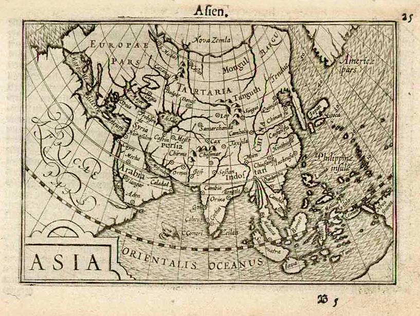
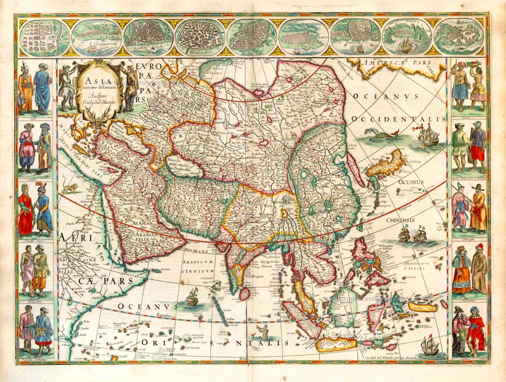
Asia. [Title above:] Asien.
Item Number: 26677 Authenticity Guarantee
Category: Antique maps > Asia > Asia
Old, antique map of Asia, by Cornelis Claesz and Barent Langenes.
Date of the first edition: 1598
Date of this map: 1598
Copper engraving, printed on paper.
Size (not including margins): 8.5 x 12.5cm (3.3 x 4.9 inches)
Verso text: Dutch
Condition: Excellent.
Condition Rating: A+
References: Van der Krogt 3, 8000:341; Yeo (Asia), #18
From: Barent Langenes. Caert-Tresoor, Inhoudende de tafelen des gansche Werelts Landen, met beschryvingen verlicht, tot lust vanden Leser, nu alles van nieus met groote costen ende arbeyt toegereet. Middelburg, Barent Langenes, 1598. (Van der Krogt 3, 341:01)
Barent Langenes ans his Caert-Thresoor
Barent Langenes, a Dutch bookseller and publisher of Middelburg (Zeeland), about whom little is known, was the first printer of the Caert-Thresoor (1598), a small-size atlas with an exciting history. This atlas had many editions in Dutch, Latin, French, and German, later brought out by Cornelis Claesz and Jodocus Hondius. Langenes was involved in the first two Dutch editions.
The Caert-Thresoor, is a collection of maps to which the text was adapted and not the reverse, as in the case with many geographical studies. The most exciting maps are those of the English and the Dutch in arctic waters, searching for the route to China (Northwest Passage). It records the departure of the third fleet of the Dutch in spring 1596, but not the return of survivors of this tragic voyage in August 1597. This atlas sets a new standard for minor atlases. Moreover, it was affordable to the citizens of the lowest income.
The text was rewritten, first by Petrus Bertius and reissued in 1600, secondly in 1609 by Jacobus Viverius. The edition with original basic text continued to be published until 1609, the year of Cornelis Claesz’s death.
Cornelis Claesz.
Printer and bookseller in Amsterdam, 1580-1609. He is famous for publishing maps, pilot guides, and atlases in the beginning period of the development of cartography in the northern Netherlands. He is noted for his co-operation with the cartographer Petrus Plancius and his editions of voyages. After 1590, the works of Lucas Jansz. He published Waghenaer, and in 1599, he acquired the publication rights of Barent Langenes’ Caert-thresoor.
The Caert-Thresoor.
The Caert-Thresoor of 1598 set a new standard for minor atlases. Scholars like Petrus Bertius and Jacobus Viverius edited the text. The small maps are exceptionally well engraved, neat, clear, and elegantly composed. They served many purposes in other books published in Amsterdam. Their contents reflect the level of cartography in Amsterdam at the turn of the century, where up-to-date information on newly discovered regions was readily available. The Caert-Thresoor is a collection of maps to which the text was adapted and not the other way around, as is the case with many geographical studies.
The first edition was published in 1598 by Barent Langenes, a bookseller and publisher in Middelburg.
The book was reissued under the title P. Bertii Tabularum Geographicarum Libri quatuor, in 1600. Bertius recomposed the contents, following Ptolemy's arrangement. Secondly, in 1609, Jacobus Viverius wrote an entirely revised Dutch text, published under the title Handboeck of Cort Begrijp des Caerten. In or after 1609, the year of Cornelis Claesz.'s death, a French edition appeared, printed by Matthaeus Becker for Hendrik Laurensz., the successor of Cornelis Claesz. Finally, an entirely new small atlas was created in 1616 by Jodocus Hondius Jr. All the maps were re-made, and the text by Bertius was revised.
The original maps from the Caert-Thresoor were used to illustrate many of the books on voyages and geography published in Amsterdam in 1596-1600. (Van der Krogt)
Related items
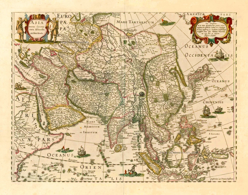
Asia Recens Summa Cura Delineata. 1644-58
Asia, by J. Janssonius
[Item number: 7508]

Accuratissima totius Asiae Tabula. c. 1691-96
Asia, by F. De Wit.
[Item number: 10960]
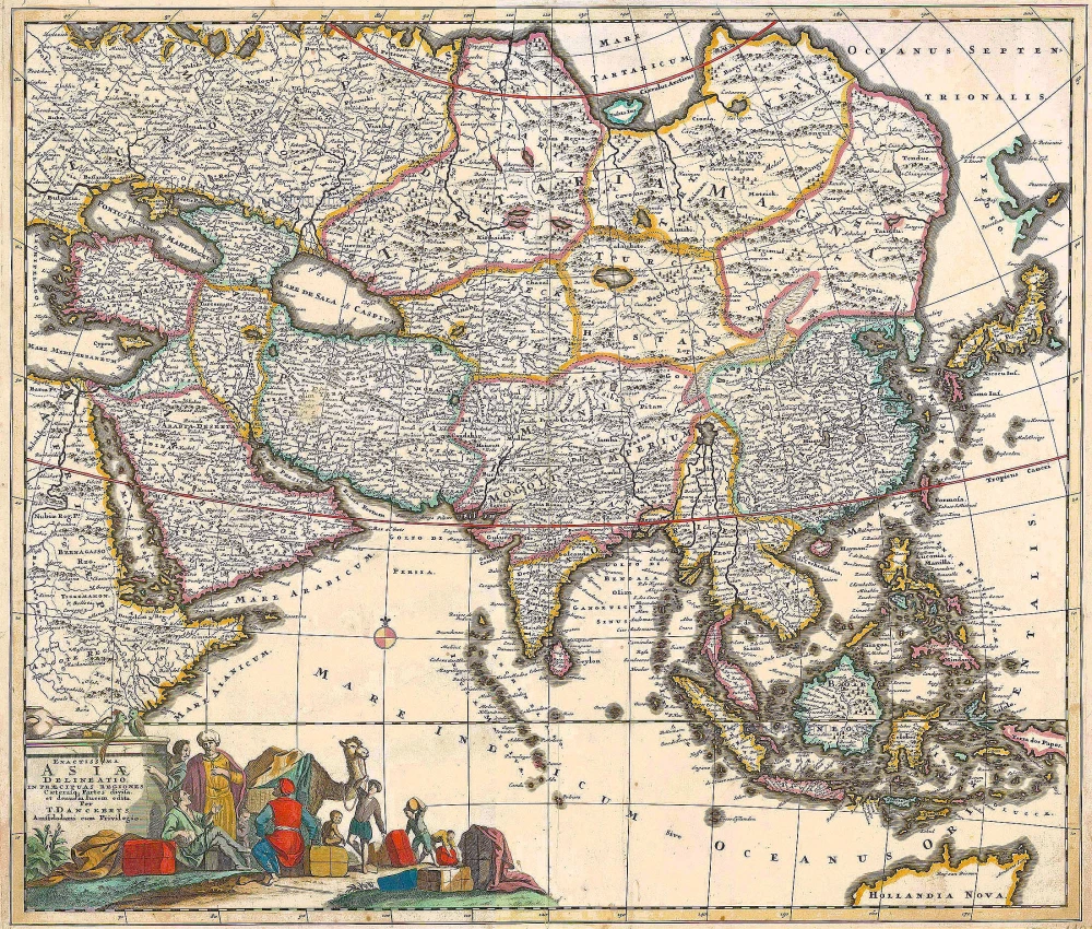
Exactissima Asiae Delineatio in praecipuas regiones Caeterasq Partes divisa. c. 1700
Asia by Th. Danckerts.
[Item number: 11298]
Asia 1602
Asia by Langenes, published by Bertius P.
[Item number: 12518]
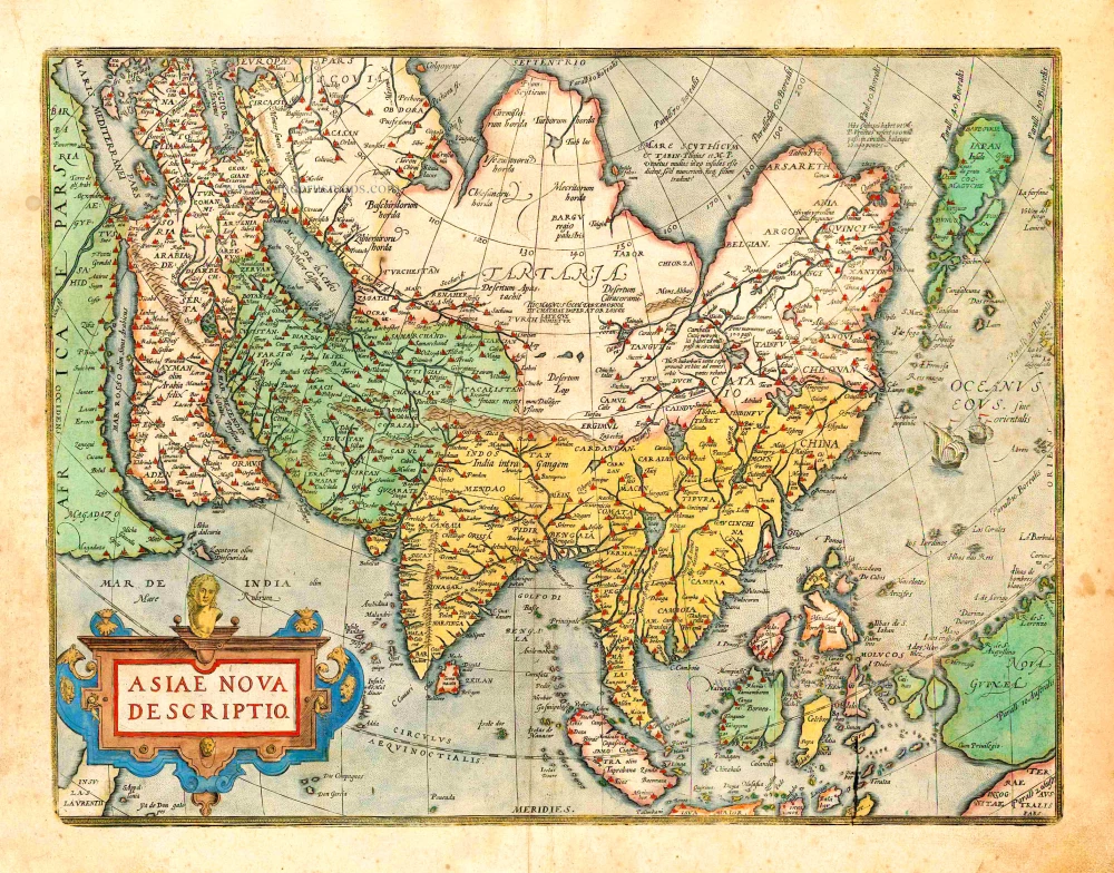
Asiae Nova Descriptio. 1612
Asia, by Abraham Ortelius.
[Item number: 22925]
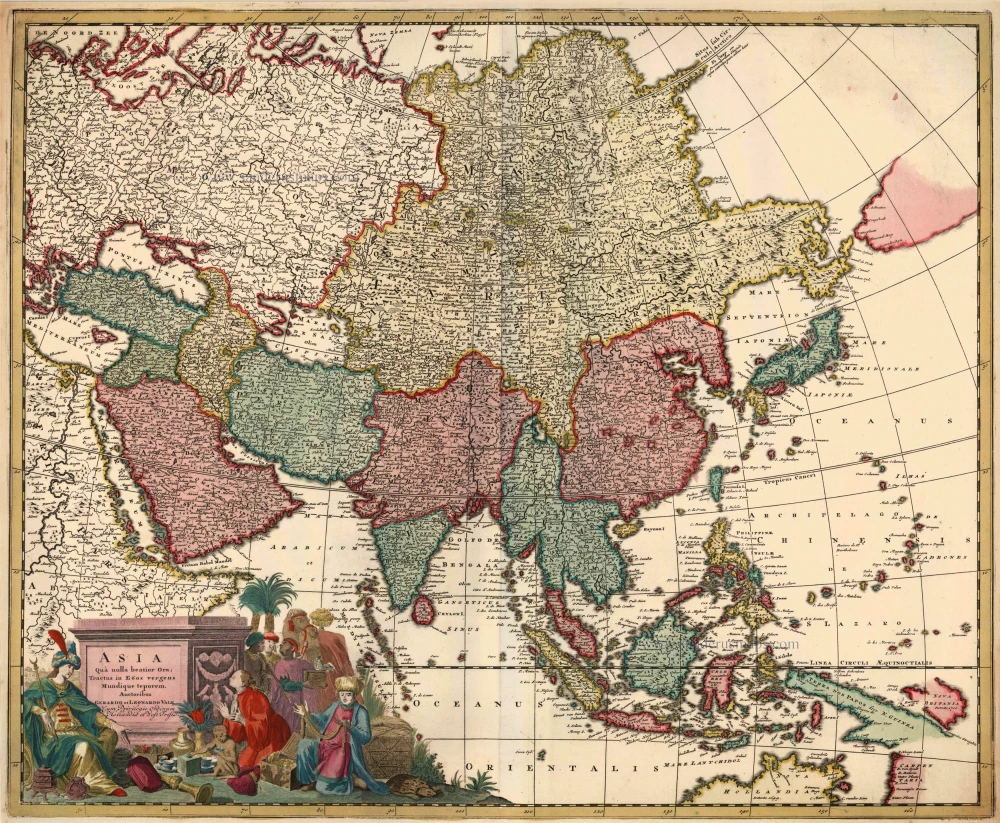
Asia qua Nulla Beatior Ora; Tractus in Eoos Vergens Mundique Teporem. c. 1730.
Asia, by G.& L. Valk.
[Item number: 24538]

Asiae in Tabula Geographica Delineatio. c. 1700
Asia by A.F. Zürner, published by Petrus Schenk.
[Item number: 25842]
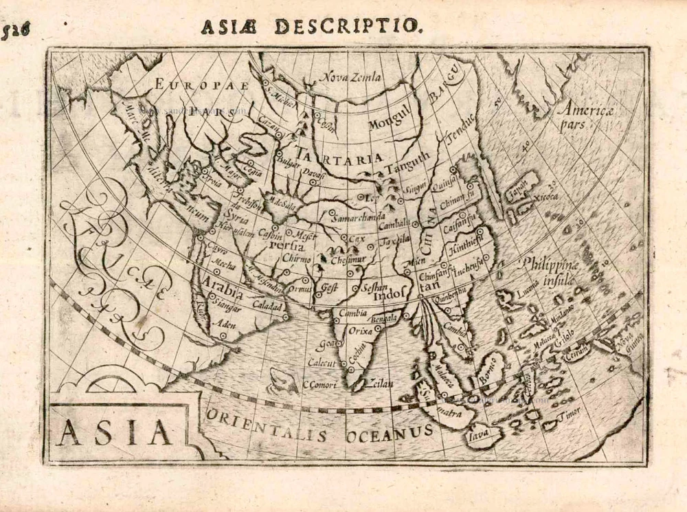
Asia. 1597
Asia, by Giovanni Magini.
[Item number: 26548]
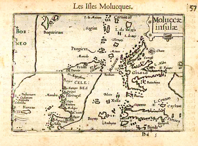
Moluccae Insulae. c. 1600
Moluccas by Barent Langenes & Cornelis Claesz
[Item number: 26996]
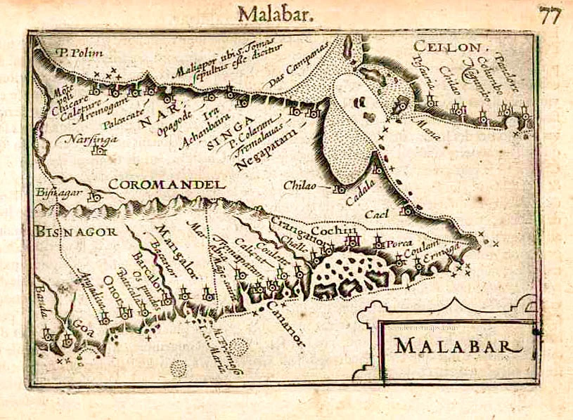
Malabar. c. 1600
Malabar by Barent Langenes & Cornelis Claesz
[Item number: 26997]
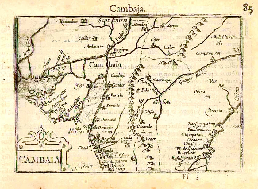
Cambaia. c. 1600
Cambay by Barent Langenes & Cornelis Claesz
[Item number: 26998]
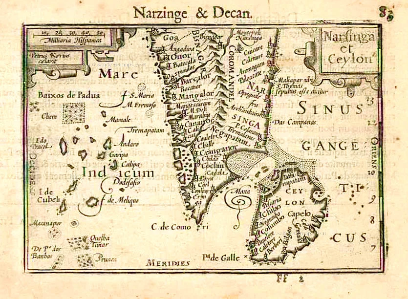
Narsinga et Ceylon. c. 1600
South India and Ceylon by Barent Langenes & Cornelis Claesz
[Item number: 26999]
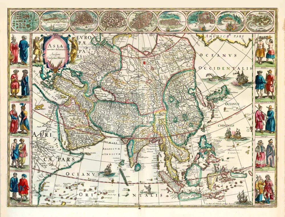
Asia Noviter Delineata. 1641-42
Asia, by Willem Blaeu.
[Item number: 27041]
Asia Noviter Delineata. 1640
Old antique map of Asia, by Willem Blaeu.
[Item number: 27151]
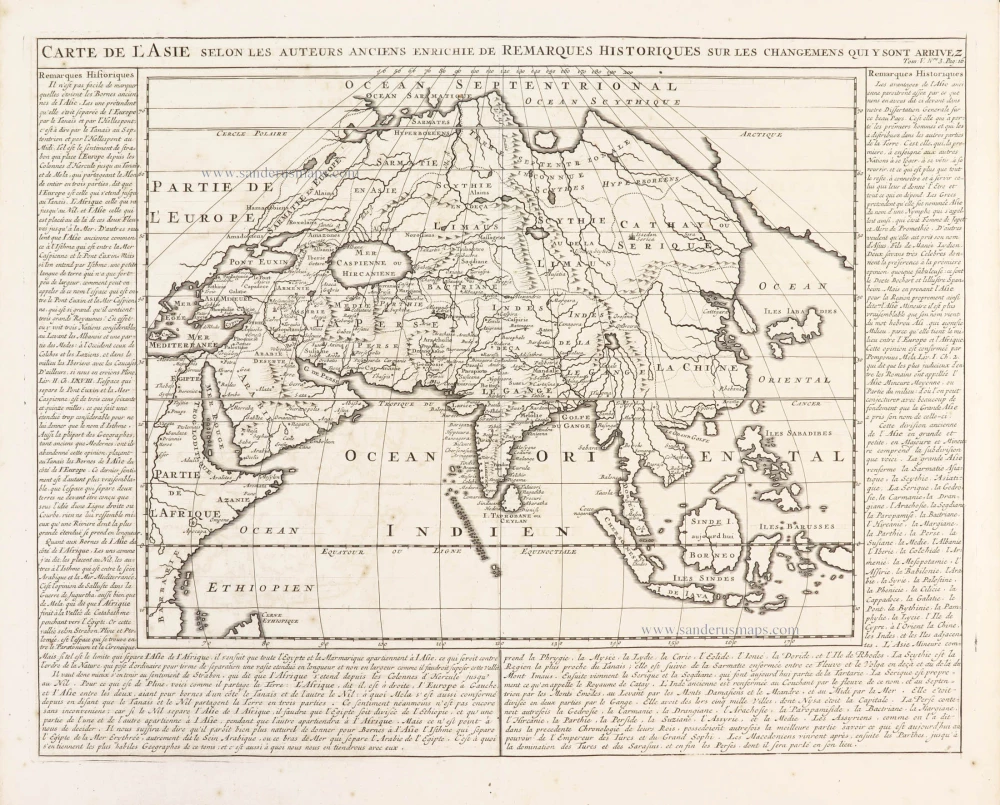
Carte de l'Asie selon les auteurs anciens enrichie de remarques historiques sur les changemens qui y sont arrivez. 1719
Asia, by Zacharias Châtelain.
[Item number: 29387]