
Asia by Langenes, published by Bertius P. 1602
Petrus Bertius (1565-1629)
Petrus Bertius, born at Beveren, Flanders in 1565, was related with Pieter van den Keere (Kaerius) and Jodocus Hondius. Both famous cartographers were brothers-in-law of Petrus Bertius. As a refugee, he settled in Amsterdam and, after finishing his studies, he became professor of mathematics and librarian at the University of Leiden. In 1618 he also became cosmographer and historiographer to Louis XIII of France and lived in Paris, where he died in 1629.
His enormous working power resulted in many geographical and theological works. He also contributed geographic materials to the works of Clüver and Herrera.
His fame among geographers was established by his text in the pocket atlas Tabularum Geographicarum and by his edition of Ptolemy’s Geographia.
The origin of the Tabularum Geographicum lies in the well-know miniature atlas Caert thresoor, published by Barent Langenes in 1598 in Middelburg. Bertius engraved 169 maps for this small but attractive atlas which was also sold for the first time in 1599 by Cornelis Claesz in Amsterdam. In 1600, Claesz published the pocket atlas with a Latin text composed by Petrus Bertius. From then on, new editions, often enlarged with new maps, regularly appeared, subsequently published by Cornellis Claesz, Jodocus Hondius, Johannes Janssonius and ultimately, in 1649, by Claes Jansz. Visscher.
Koeman divides this series of pocketbooks into two atlases: The Caert-thresoor, published by Langenes and Claesz., with five editions between 1598 and 1609; and the Tabularum Geographicarum Contractarum by Petrus Bertius with ten editions between 1600 and 1650.
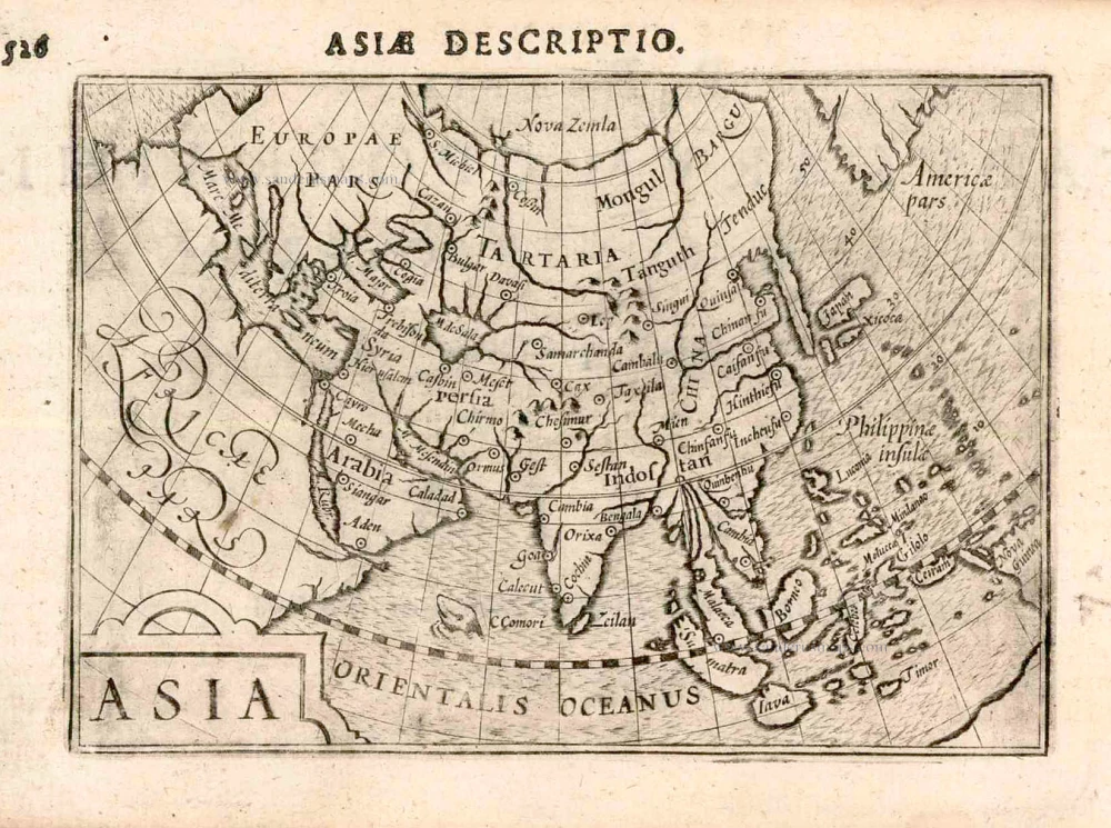
Asia
Item Number: 12518 Authenticity Guarantee
Category: Antique maps > Asia > Asia
Old antique map of Asia by Langenes, published by Bertius P.
Title: Asia.
Date of the first edition: 1598.
Date of this map: 1602.
Copper engraving, printed on paper.
Size (not including margins): 87 x 125mm (3.43 x 4.92 inches).
Verso: Latin text.
Condition: Excellent.
Condition Rating: A+.
From: BERTIUS P. Tabulae Geographicae contractae, ... Amsterdam, C. Claesz., 1602/03.
Petrus Bertius (1565-1629)
Petrus Bertius, born at Beveren, Flanders in 1565, was related with Pieter van den Keere (Kaerius) and Jodocus Hondius. Both famous cartographers were brothers-in-law of Petrus Bertius. As a refugee, he settled in Amsterdam and, after finishing his studies, he became professor of mathematics and librarian at the University of Leiden. In 1618 he also became cosmographer and historiographer to Louis XIII of France and lived in Paris, where he died in 1629.
His enormous working power resulted in many geographical and theological works. He also contributed geographic materials to the works of Clüver and Herrera.
His fame among geographers was established by his text in the pocket atlas Tabularum Geographicarum and by his edition of Ptolemy’s Geographia.
The origin of the Tabularum Geographicum lies in the well-know miniature atlas Caert thresoor, published by Barent Langenes in 1598 in Middelburg. Bertius engraved 169 maps for this small but attractive atlas which was also sold for the first time in 1599 by Cornelis Claesz in Amsterdam. In 1600, Claesz published the pocket atlas with a Latin text composed by Petrus Bertius. From then on, new editions, often enlarged with new maps, regularly appeared, subsequently published by Cornellis Claesz, Jodocus Hondius, Johannes Janssonius and ultimately, in 1649, by Claes Jansz. Visscher.
Koeman divides this series of pocketbooks into two atlases: The Caert-thresoor, published by Langenes and Claesz., with five editions between 1598 and 1609; and the Tabularum Geographicarum Contractarum by Petrus Bertius with ten editions between 1600 and 1650.
Related items

Accuratissima totius Asiae Tabula. c. 1691-96
Asia, by F. De Wit.
[Item number: 10960]
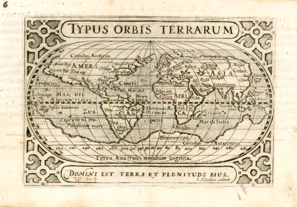
Typus Orbis Terrarum. 1602
World by Barent Langenes
[Item number: 12009]
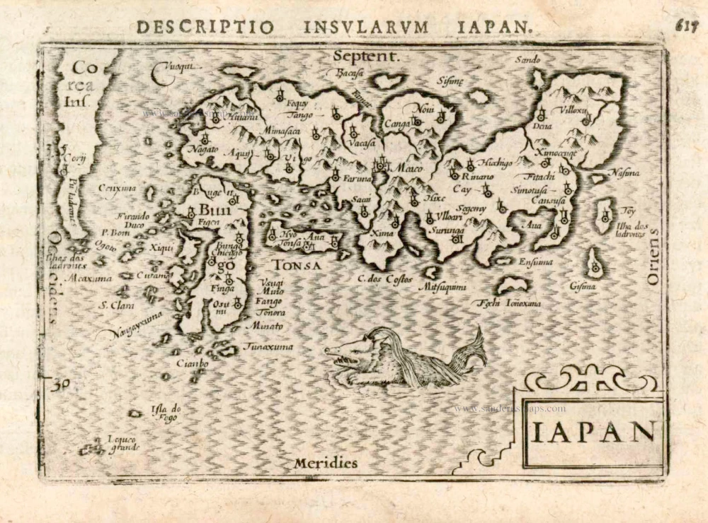
Iapan. 1602
Japan by Langenes, published by Bertius P.
[Item number: 12487]

America 1602
America by Langenes, published by Bertius P.
[Item number: 12494]
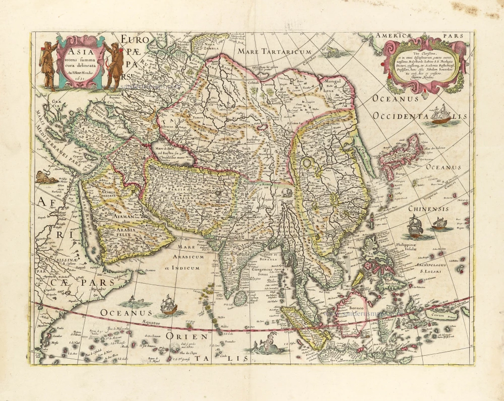
Asia Recens Summa Cura Delineata. 1639
ASIA by Hondius H.
[Item number: 24473]

Asiae in Tabula Geographica Delineatio. c. 1700
Asia by A.F. Zürner, published by Petrus Schenk.
[Item number: 25842]
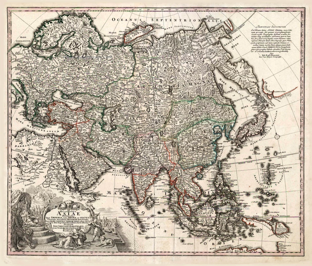
Recentissima Asiae Delineatio qua Imperia, ejus Regna et Status ... 1730-37
Asia, by Homann Johann Christoph.
[Item number: 26733]
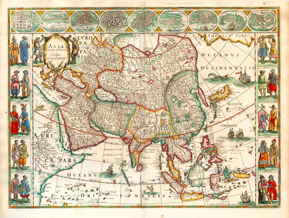
Asia Noviter Delineata. 1641-42
Asia, by Willem Blaeu.
[Item number: 27041]
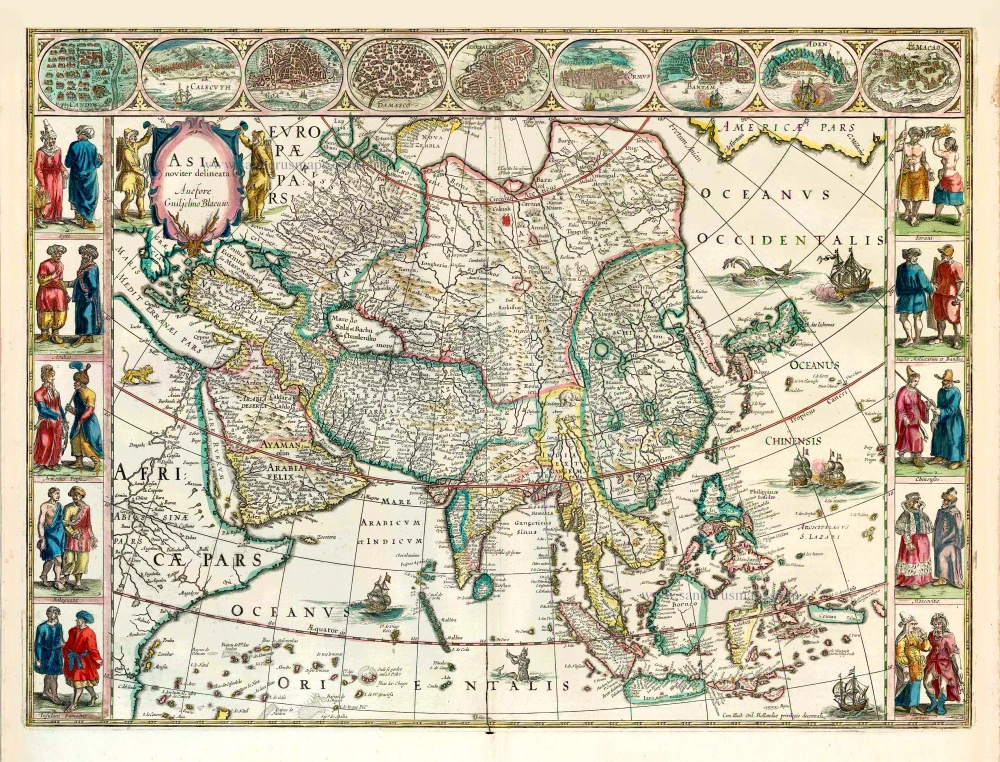
Asia Noviter Delineata. 1640
Old antique map of Asia, by Willem Blaeu.
[Item number: 27151]
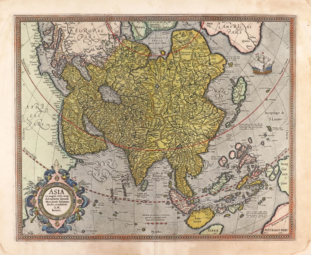
Asia ex magna orbis terre descriptione Gerardi Mercatoris desumpta studio et industria G.M. Iunioris. 1613
Asia, by Gerard Mercator.
[Item number: 28072]
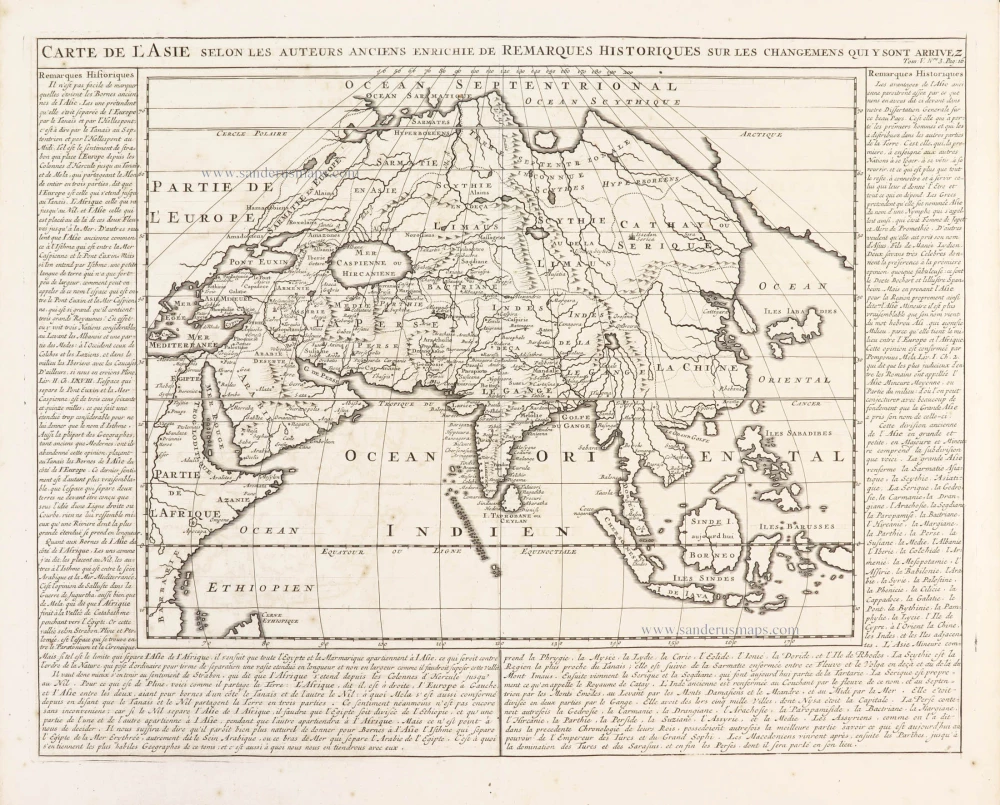
Carte de l'Asie selon les auteurs anciens enrichie de remarques historiques sur les changemens qui y sont arrivez. 1719
Asia, by Zacharias Châtelain.
[Item number: 29387]
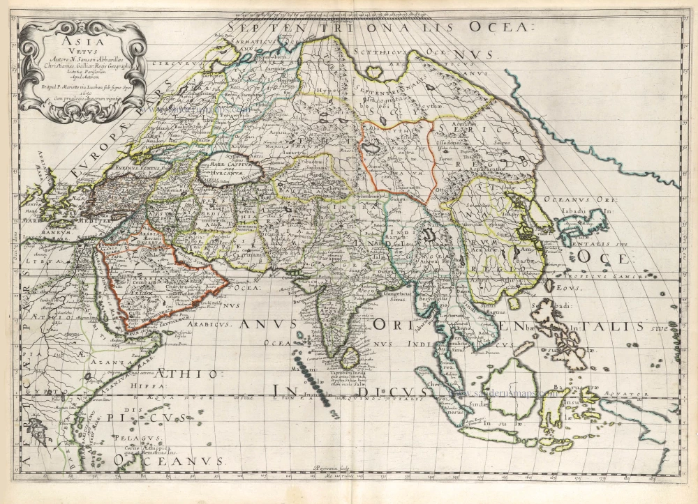
Asia Vetus. 1652
Ancient Asia by Nicolas Sanson.
[Item number: 29687]
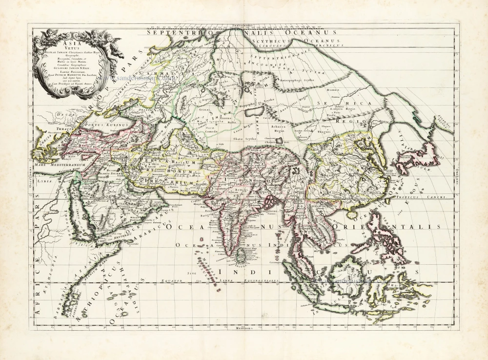
Asia Vetus. 1667-69
Ancient Asia by Nicolas & Guillaume Sanson.
[Item number: 30002]
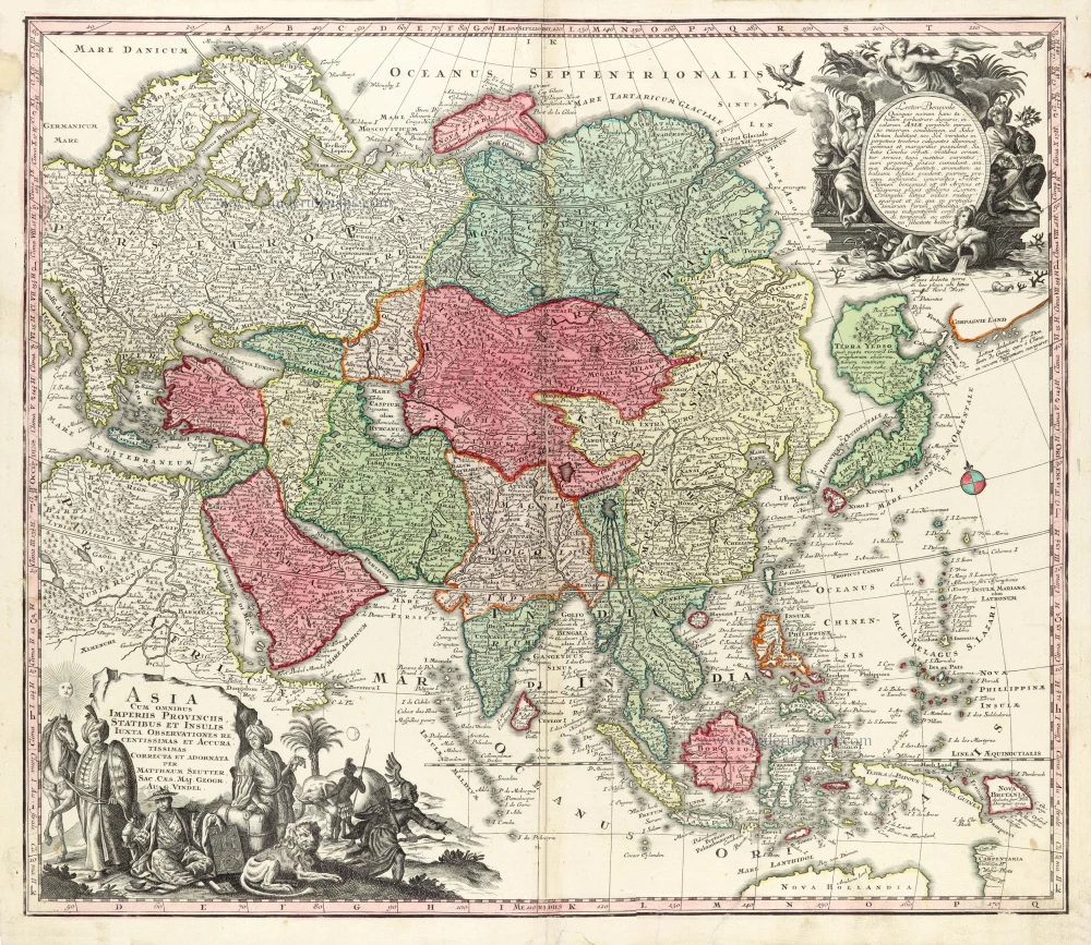
Asia Cum omnibus Imperiis Provinciis, Statibus et Insulis Iuxta Observationes receentissimas et Accuratissimas Correcta et Adornata. 1728
Asia by Matthäus Seutter.
[Item number: 30201]

Asia Antiqua cum finitimis Africae et Europae Regionibus. 1675
Antique map of Asia by Janssonius à Waesberghe -
[Item number: 30385]
new
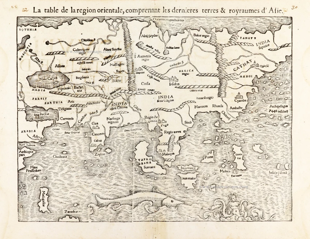
La table de la region orientale, comprenant les derniered terres & royraumes d'Asie. 1568
Asia by Sebastian Munster.
[Item number: 30528]
new