
The Philippines, by George Anson. 1748
Captain George Anson (1697-1762)
Later Admiral of the Fleet. Circumnavigator in 1740-44.
Captain George Anson led a squadron of eight ships on a mission to disrupt or capture the Pacific Ocean possessions of the Spanish Empire. He left Hampshire, England, in 1740 and returned to Britain in 1744 by way of China, thus completing a circumnavigation of the globe.
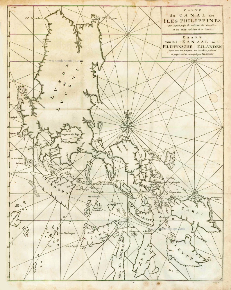
Carte du Canal des Iles Philippines par lequel Passe le Galion de Manille et les Iles Voisines de ce Canal. - Kaart van het Kanaal in de Filippynsche Eilanden waar door het Galjoen van Manilla passeert, tegelijk met de naast gelegen Eilanden.
Item Number: 27036 Authenticity Guarantee
Category: Antique maps > Asia > Southeast Asia
Old antique map of the Philippines, by George Anson.
Title: Carte du Canal des Iles Philippines par lequel Passe le Galion de Manille et les Iles Voisines de ce Canal. - Kaart van het Kanaal in de Filippynsche Eilanden waar door het Galjoen van Manilla passeert, tegelijk met de naast gelegen Eilanden.
Date of the first edition: 1748.
Date of this map: 1748.
Copper engraving, printed on paper.
Size (not including margins): 535 x 420mm (21.06 x 16.54 inches).
Verso: Blank.
Condition: Folded as issued, excellent.
Condition Rating: A+.
From: Anson G. Reize rondom de wereld. Amsterdam, 1748.
Captain George Anson (1697-1762)
Later Admiral of the Fleet. Circumnavigator in 1740-44.
Captain George Anson led a squadron of eight ships on a mission to disrupt or capture the Pacific Ocean possessions of the Spanish Empire. He left Hampshire, England, in 1740 and returned to Britain in 1744 by way of China, thus completing a circumnavigation of the globe.
Related items
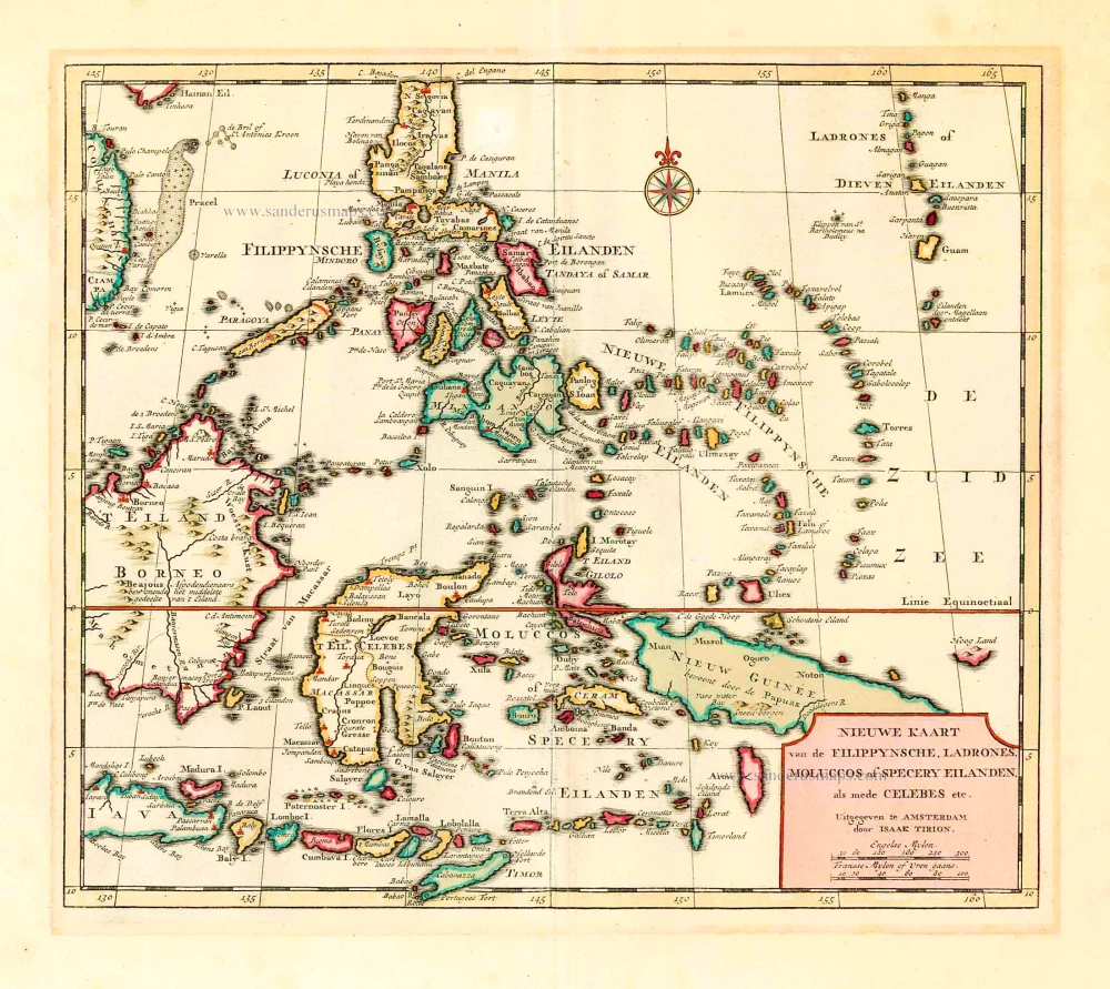
Nieuwe Kaart van de Filippynsche, Ladrones, Moluccos of Specery Eilanden als mede Celebes, etc. 1744
Philippines - Indonesia by Tirion I.
[Item number: 26584]
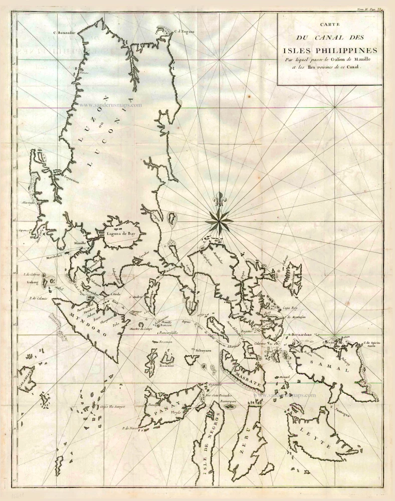
Carte du Canal des Iles Philippines par lequel Passe le Galion de Manille et les Iles Voisines de ce Canal. 1749
Philippines by Bonne Rigobert
[Item number: 26611]
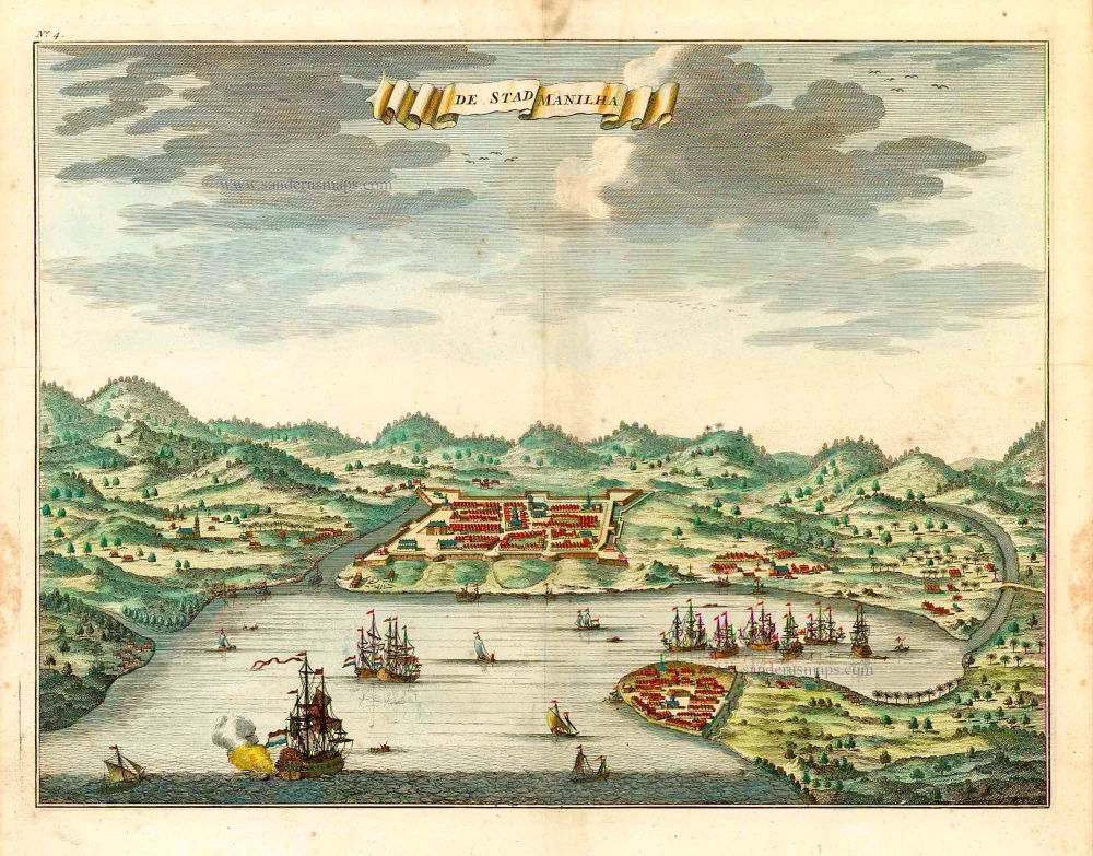
De Stad Manilha. 1724-26
Philippines - Manilla by François Valentyn (Valentijn)
[Item number: 27064]
Including the first map of the Philippines.
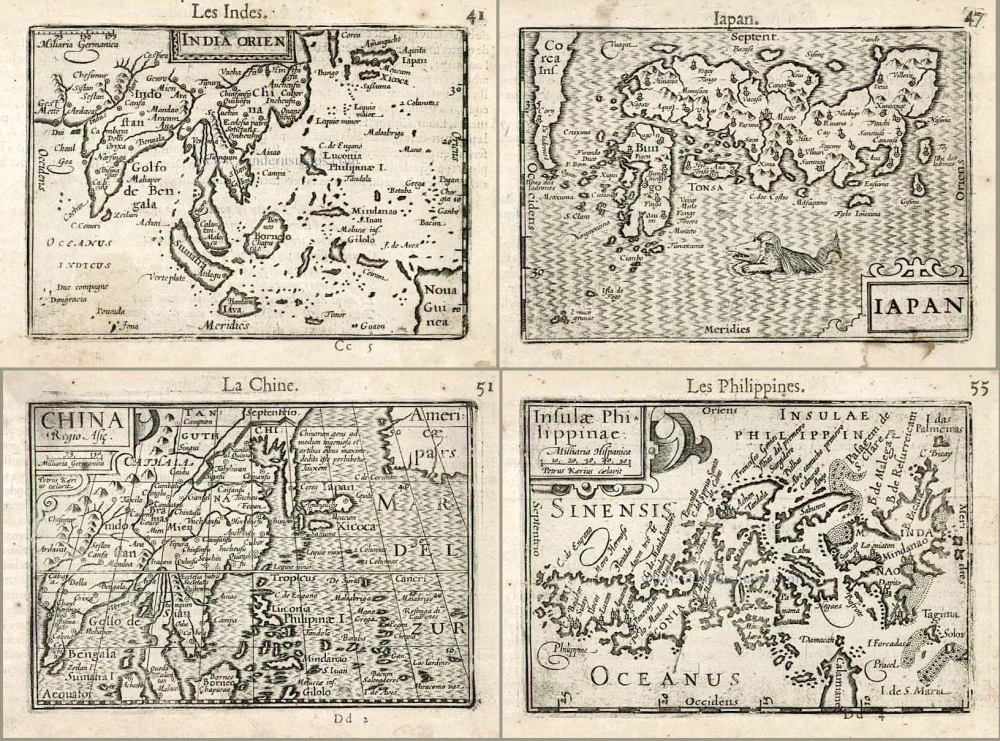
India Orien. - Iapan. - China. - Insulae Philippinae. 1602
Barent Langenes & Cornelis Claesz.: Southeast Asia, Japan, China, and the Philippines.
[Item number: 27705]
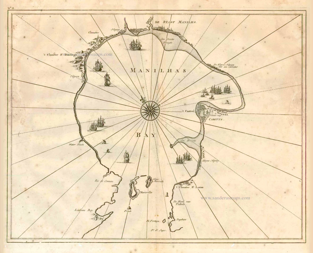
Manilhas Bay. 1724-26
Philippine Islands - Manila Bay by François Valentyn (Valentijn)
[Item number: 27904]
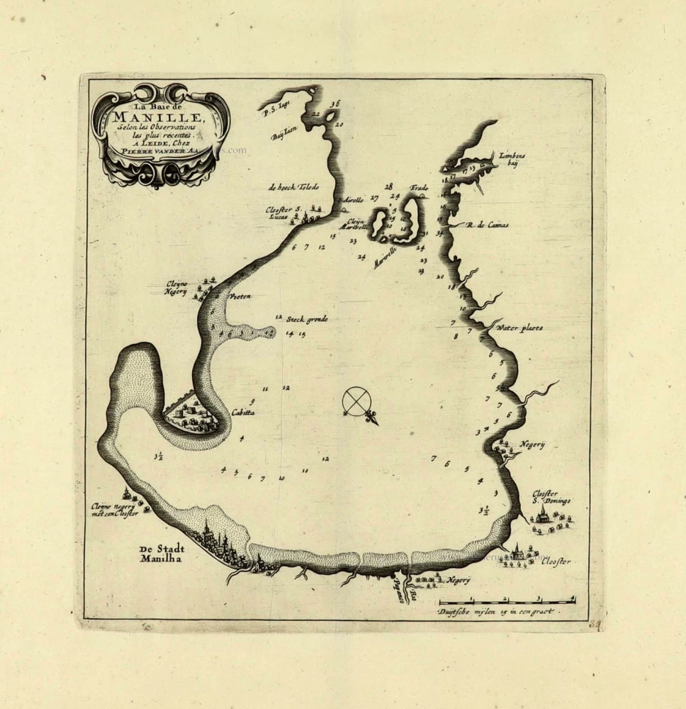
La Baie de Manille. 1719
Manilla Bay, par Pieter van der Aa.
[Item number: 28115]
First edition
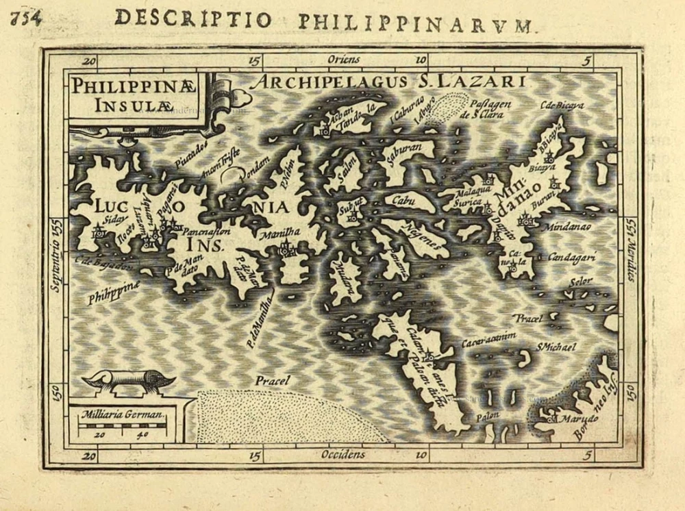
Philippinae Insulae. 1616
Philippines by Petrus Bertius.
[Item number: 28166]
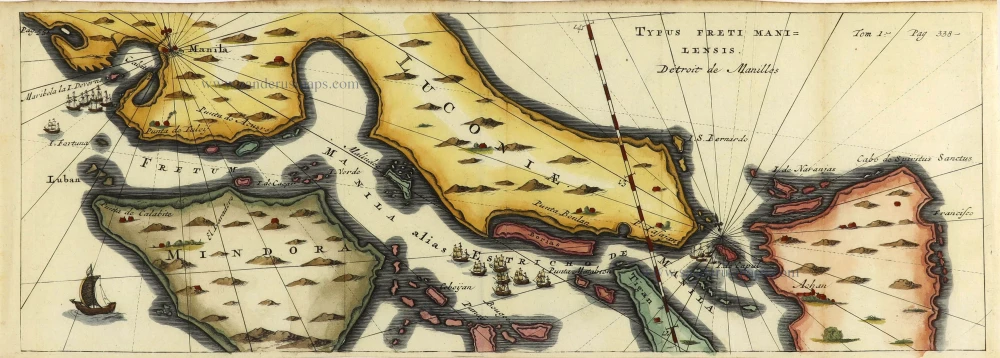
Typus Freti Manilensis. - Détroit de Manilles. 1725
Philippines - Manila Strait by René Augustin Constantin de Renneville.
[Item number: 28370]
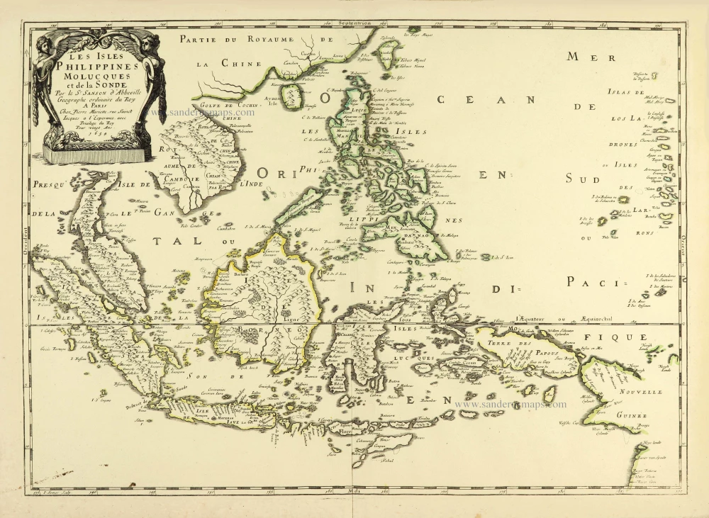
Les Isles Philippines Molucques et de la Sonde. 1658
Philippines par Nicolas Sanson.
[Item number: 28378]
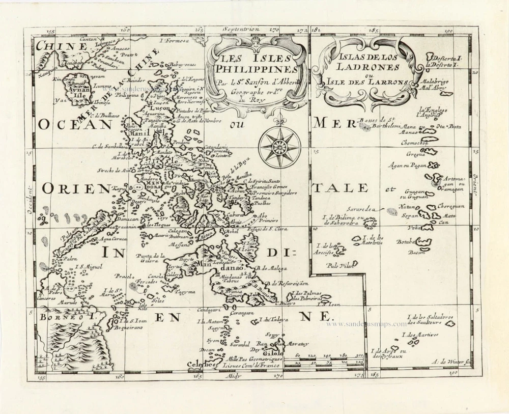
Les Isles Philippines [on sheet with] Islas de los Ladrones ou Isle des Larrons. 1747-74
Philippines, by Nicolas Sanson, published by Prevost d'Exiles.
[Item number: 30304]