
Old antique map of the Straits of Magellan & Terra Australis, by Johannes Metellus. 1600
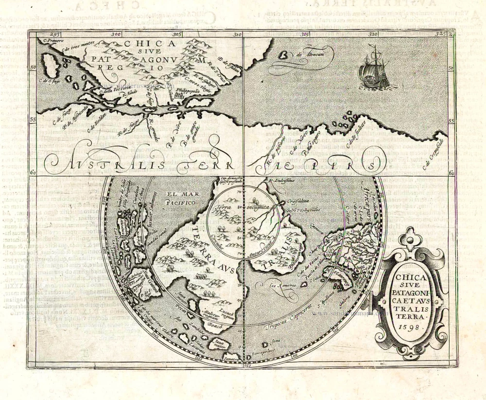
Chica sive Patagonica et Australis Terra. 1598.
Item Number: 26942 Authenticity Guarantee
Category: Antique maps > Australia
Old, antique map of the Straits of Magellan and Terra Australis, by Johannes Metellus.
Map in two sections: the upper section shows the Straits of Magellan, the lower section the unknown part of the Terra Australis.
Date of the first edition: 1600
Date of this map: 1600
Date on map; 1598
Copper engraving, printed on paper.
Size (not including margins): 22.5 x 28.5cm (8.8 x 11.1 inches)
Verso text: Latin
Condition: A few reinforcements at the back.
Condition Rating: B+
References: Meurer (Cologne), Met 9 (19).
From: America, sive Novus Orbis. Tabulis Aeneis Secundum Rationes Geographicas Delineatus. Cologne, 1600. (Meurer, Met 9)
Related items
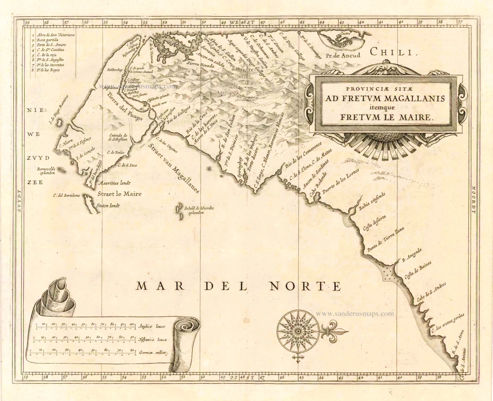
Provinciae Sitae ad Fretum Magallanis itemque Fretum le Maire. 1630
Magellan Straits & Tierra Del Fuego, by Johannes de Laet.
[Item number: 25391]
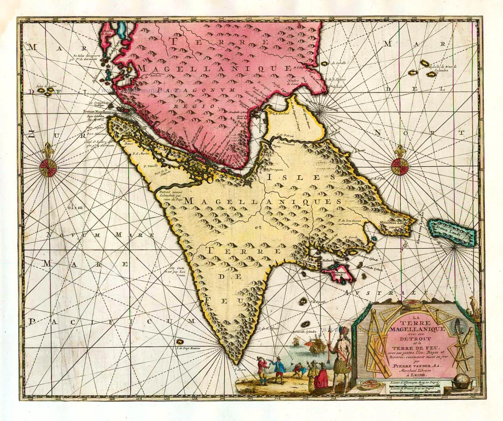
La Terre Magellanique avec son Détroit et la Terre de Feu, avec ses petites Iles, Bayes et Rivieres. 1713
Magellan Straits & Tierra del Fuego, by Pieter van der Aa.
[Item number: 26153]