
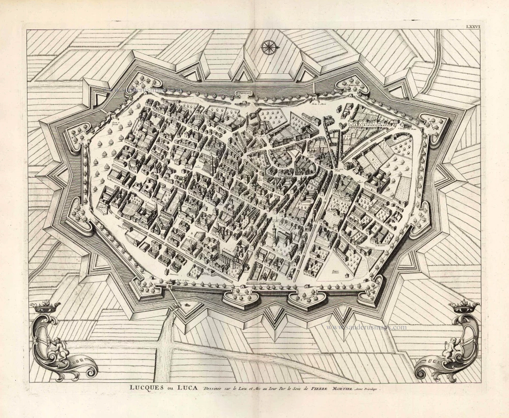
Lucca by Braun Georg & Hogenberg Frans c. 1593
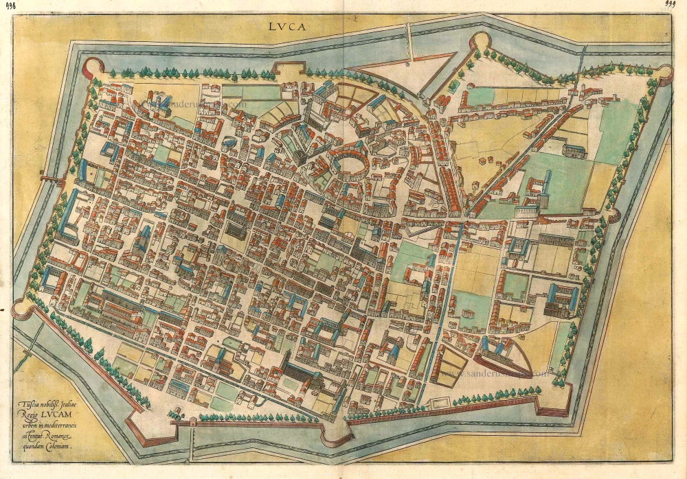


TRANSLATION OF CAPTION: Tuscany is a celebrated region in Italy, with the city of Lucca, once a Roman colony, shown in its midst.
COMMENTARY BY BRAUN (on verso): "It lies in a plain not far from the mountains. It possesses quite handsome buildings and admirable circumspect yet pleasure-loving inhabitants, who have succeeded in preserving their independence for a long time although their neighbours have frequently waged war with them."
Looking almost due north, this view of Lucca is depicted from a vantage point directly above the city. The exacting perspective creates some optical distortions in the representation of the buildings. The city wall (1504-1645), which still exists, neatly encloses the urban space within moats and bastions. Immediately recognizable at the top centre is the Piazza dell'Anfiteatro, which describes almost a complete circle. The city's principal church, the Cathedral of San Martino, with its bell tower and the cathedral square in front, is discernible above the bastion on the lower fringes of the city. At the centre left is San Michele in Foro, set in a green field. About 20 km northeast of Pisa, Lucca was founded by the Etruscans. During the Middle Ages, it was much fought over, but from the second half of the 14th century, it managed to preserve its independence until the First French Republic. (Taschen)
Braun G. & Hogenberg F. and the Civitates Orbis Terrarum.
The Civitates Orbis Terrarum, or the "Braun & Hogenberg", is a six-volume town atlas and the most excellent book of town views and plans ever published: 363 engravings, sometimes beautifully coloured. It was one of the best-selling works in the last quarter of the 16th century. Georg Braun wrote the text accompanying the plans and views on the verso. Many plates were engraved after the original drawings of a professional artist, a professional artist, Joris Hoefnagel (1542-1600). The first volume was published in Latin in 1572, and the sixth in 1617. Frans Hogenberg created the tables for volumes I through IV, and Simon van den Neuwel made those for volumes V and VI. Other contributors were cartographers Daniel Freese and Heinrich Rantzau. Works by Jacob van Deventer, Sebastian Münster, and Johannes Stumpf were also used. Translations appeared in German and French.
Following the original publication of Volume 1 of the Civitates in 1572, seven further editions of 1575, 1577, 1582, 1588, 1593, 1599 and 1612 can be identified. Vol.2, first issued in 1575, was followed by further editions in 1597 and 1612. The subsequent volumes appeared in 1581, 1588, 1593, 1599 and 1606. The German translation of the first volume appeared from 1574 on, and the French edition from 1575 on.
Several printers were involved: Theodor Graminaeus, Heinrich von Aich, Gottfried von Kempen, Johannis Sinniger, Bertram Buchholtz and Peter von Brachel, who all worked in Cologne.
Georg Braun (1541-1622)
Georg Braun was born in Cologne in 1541. After his studies in Cologne, he entered the Jesuit Order as a novice. 1561, he obtained his bachelor's degree, and in 1562, he received his Magister Artium. Although he left the Jesuit Order, he studied theology, gaining a licentiate in theology.
Frans Hogenberg (1535-1590)
Frans Hogenberg was a Flemish and German painter, engraver, and mapmaker. He was born in Mechelen as the son of Nicolaas Hogenberg.
By the end of the 1560s, Frans Hogenberg was employed upon Abraham Ortelius's Theatrum Orbis Terrarum, published in 1570; he is named an engraver of numerous maps. In 1568, he was banned from Antwerp by the Duke of Alva and travelled to London, where he stayed a few years before emigrating to Cologne. He immediately embarked on his two most important works, the Civitates, published in 1572 and the Geschichtsblätter, which appeared in several series from 1569 until about 1587.
Thanks to large-scale projects like the Geschichtsblätter and the Civitates, Hogenberg's social circumstances improved with each passing year. He died as a wealthy man in Cologne in 1590.
Luca.
Item Number: 24580 Authenticity Guarantee
Category: Antique maps > Europe > Italy - Cities
Old, antique bird’s-eye view plan of Lucca by Braun Georg & Hogenberg Frans.
Title: Luca.
Date of the first edition: 1588.
Date of this map: c. 1593.
Copper engraving, printed on paper.
Map size: 355 x 520mm (13.98 x 20.47 inches).
Sheet size: 210 x 540mm (8.27 x 21.26 inches).
Verso: French text.
Condition: Original coloured, excellent.
Condition Rating: A+.
From: Liber Quartus - Livre Quatriesme des Principales Villes du Monde, 1593. (Van der Krogt 4, 41:3.4(1593))
TRANSLATION OF CAPTION: Tuscany is a celebrated region in Italy, with the city of Lucca, once a Roman colony, shown in its midst.
COMMENTARY BY BRAUN (on verso): "It lies in a plain not far from the mountains. It possesses quite handsome buildings and admirable circumspect yet pleasure-loving inhabitants, who have succeeded in preserving their independence for a long time although their neighbours have frequently waged war with them."
Looking almost due north, this view of Lucca is depicted from a vantage point directly above the city. The exacting perspective creates some optical distortions in the representation of the buildings. The city wall (1504-1645), which still exists, neatly encloses the urban space within moats and bastions. Immediately recognizable at the top centre is the Piazza dell'Anfiteatro, which describes almost a complete circle. The city's principal church, the Cathedral of San Martino, with its bell tower and the cathedral square in front, is discernible above the bastion on the lower fringes of the city. At the centre left is San Michele in Foro, set in a green field. About 20 km northeast of Pisa, Lucca was founded by the Etruscans. During the Middle Ages, it was much fought over, but from the second half of the 14th century, it managed to preserve its independence until the First French Republic. (Taschen)
Braun G. & Hogenberg F. and the Civitates Orbis Terrarum.
The Civitates Orbis Terrarum, or the "Braun & Hogenberg", is a six-volume town atlas and the most excellent book of town views and plans ever published: 363 engravings, sometimes beautifully coloured. It was one of the best-selling works in the last quarter of the 16th century. Georg Braun wrote the text accompanying the plans and views on the verso. Many plates were engraved after the original drawings of a professional artist, a professional artist, Joris Hoefnagel (1542-1600). The first volume was published in Latin in 1572, and the sixth in 1617. Frans Hogenberg created the tables for volumes I through IV, and Simon van den Neuwel made those for volumes V and VI. Other contributors were cartographers Daniel Freese and Heinrich Rantzau. Works by Jacob van Deventer, Sebastian Münster, and Johannes Stumpf were also used. Translations appeared in German and French.
Following the original publication of Volume 1 of the Civitates in 1572, seven further editions of 1575, 1577, 1582, 1588, 1593, 1599 and 1612 can be identified. Vol.2, first issued in 1575, was followed by further editions in 1597 and 1612. The subsequent volumes appeared in 1581, 1588, 1593, 1599 and 1606. The German translation of the first volume appeared from 1574 on, and the French edition from 1575 on.
Several printers were involved: Theodor Graminaeus, Heinrich von Aich, Gottfried von Kempen, Johannis Sinniger, Bertram Buchholtz and Peter von Brachel, who all worked in Cologne.
Georg Braun (1541-1622)
Georg Braun was born in Cologne in 1541. After his studies in Cologne, he entered the Jesuit Order as a novice. 1561, he obtained his bachelor's degree, and in 1562, he received his Magister Artium. Although he left the Jesuit Order, he studied theology, gaining a licentiate in theology.
Frans Hogenberg (1535-1590)
Frans Hogenberg was a Flemish and German painter, engraver, and mapmaker. He was born in Mechelen as the son of Nicolaas Hogenberg.
By the end of the 1560s, Frans Hogenberg was employed upon Abraham Ortelius's Theatrum Orbis Terrarum, published in 1570; he is named an engraver of numerous maps. In 1568, he was banned from Antwerp by the Duke of Alva and travelled to London, where he stayed a few years before emigrating to Cologne. He immediately embarked on his two most important works, the Civitates, published in 1572 and the Geschichtsblätter, which appeared in several series from 1569 until about 1587.
Thanks to large-scale projects like the Geschichtsblätter and the Civitates, Hogenberg's social circumstances improved with each passing year. He died as a wealthy man in Cologne in 1590.
Related items
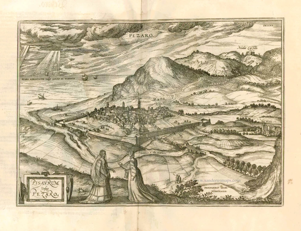
Pisaurum Vulgo Pezaro. 1582
Pesaro by Braun & Hogenberg.
[Item number: 14164]
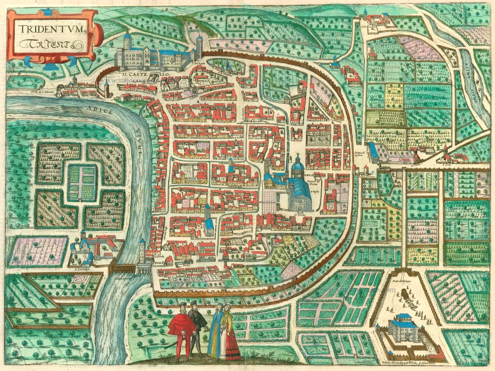
Tridentum. Trient. 1599
Trente (Trento) by Georg Braun & Frans Hogenberg
[Item number: 24063]
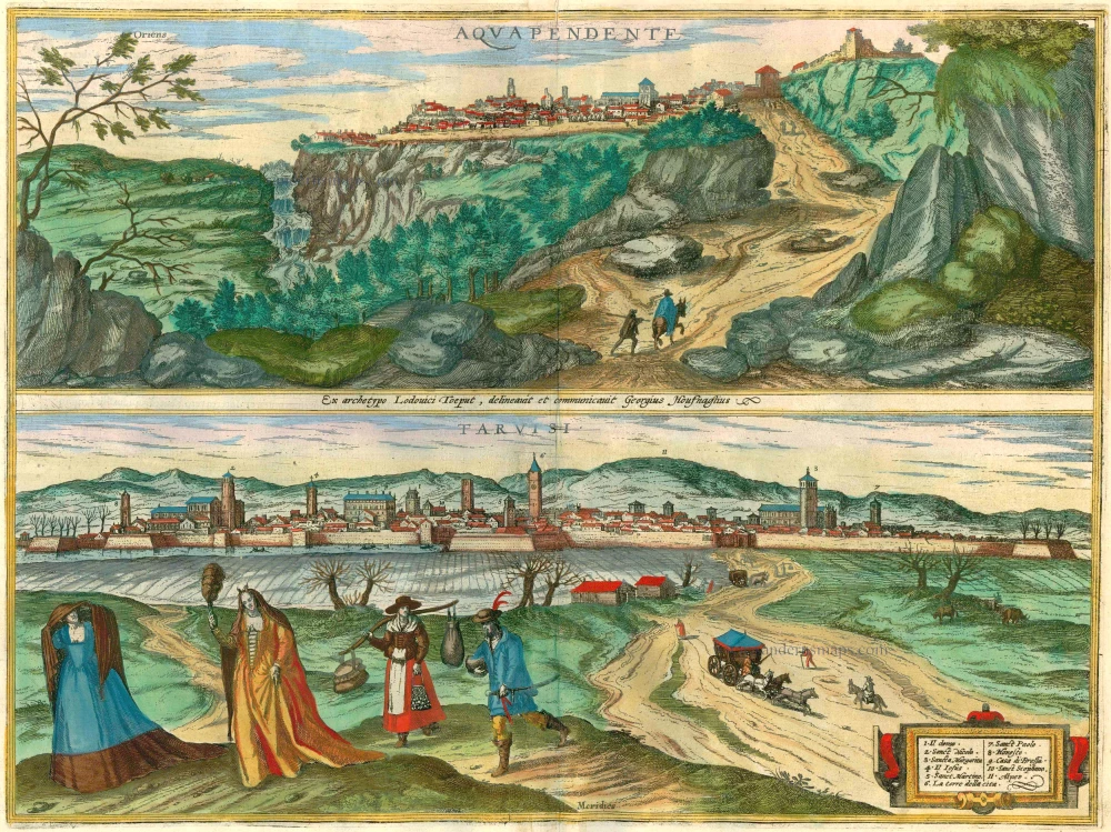
Aquapendente [on sheet with] Tarvisi 1596-1640
Acquapendente and Tarvisio by Braun and Hogenberg.
[Item number: 24195]
Lucques ou Luca. 1704
Lucca, by Pieter Mortier.
[Item number: 27847]
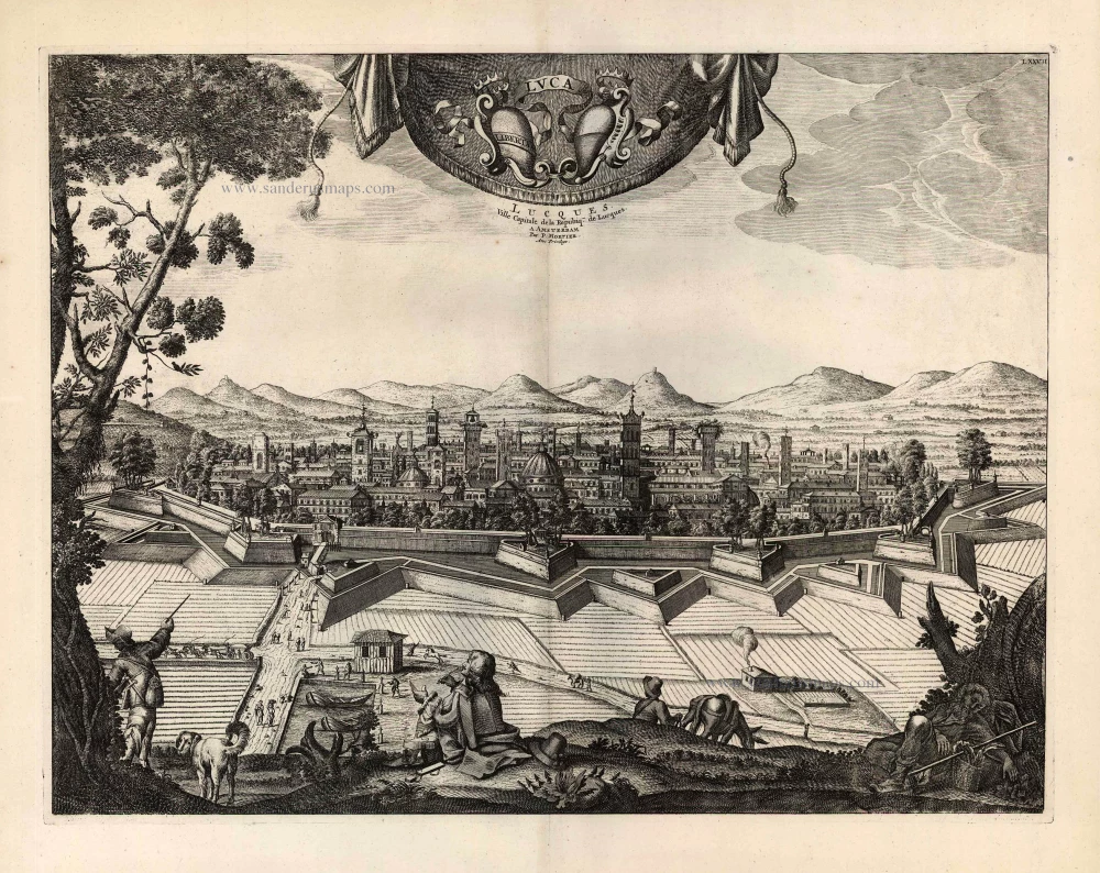
Lucques, Ville Capitale de la Repubiq de Lucques. 1704
Lucca, view by Pieter Mortier.
[Item number: 27848]

Stato della Republica di Lucca. 1640
Lucca by Willem & Joan Blaeu.
[Item number: 28302]
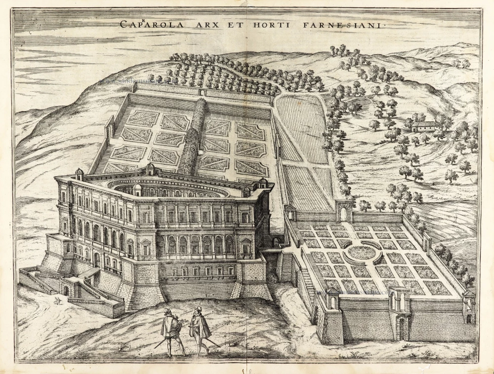
Caprarola arx et horti Farnesiani. 1600
Caprarola (Latium) and the Farnese Palace, by Georg Braun and Frans Hogenberg.
[Item number: 30110]