
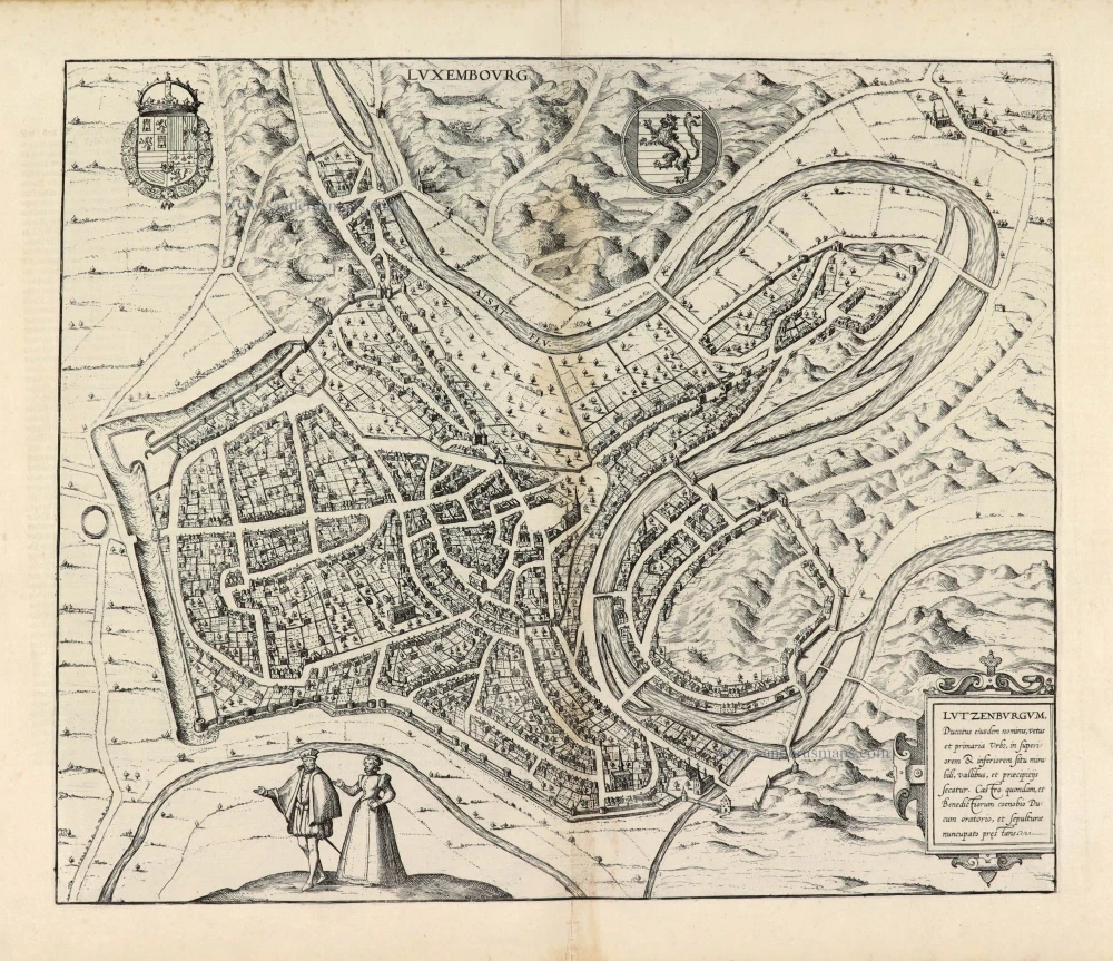
Luxembourg by Georg Braun & Frans Hogenberg 1581
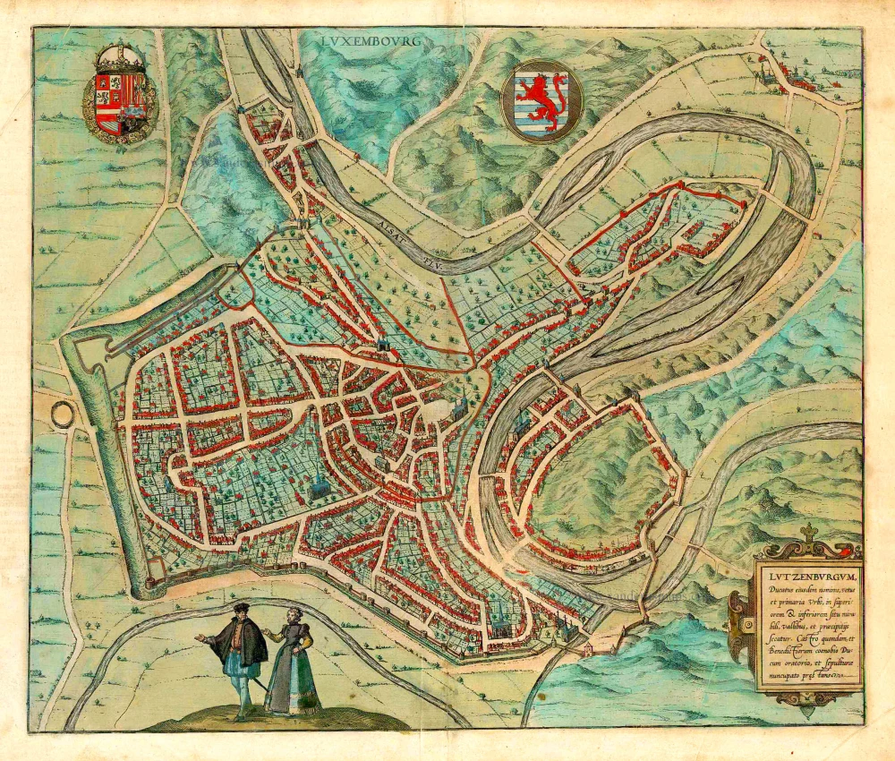
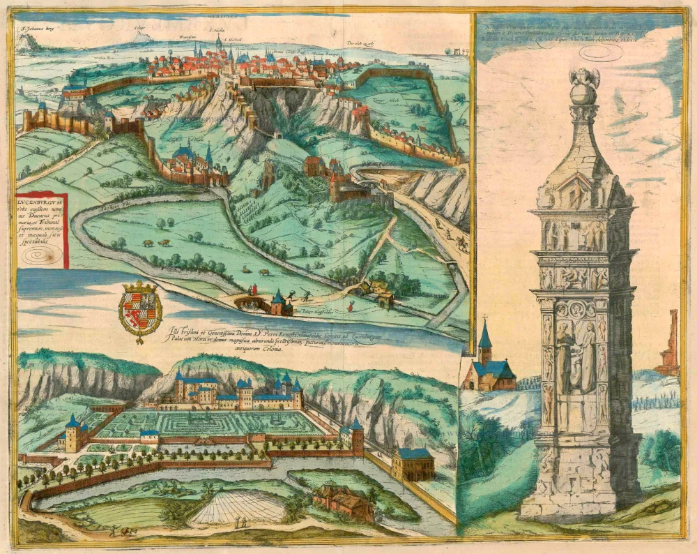
TRANSLATION OF CARTOUCHE TEXT: Luxembourg, the old capital of the duchy of the same name, [...] it was once noteworthy on account of a fortress, a Benedictine monastery and a funerary chapel of the dukes.
COMMENTARY BY BRAUN (on verso): "Although in Luxembourg a large part of the population is German, court proceedings are conducted partly in German and partly in French, according to whether the towns or villages use one language more than the other. Since Luxembourg borders France and Germany, people use the customs and language of whichever country is nearest. The townspeople's houses are well kept, but those that were destroyed during numerous military conflicts have not always been rebuilt and remain partly deserted and empty. Luxembourg is fortified, but it lies in a hilly landscape, partly on top of the mountains, partly in relatively deep valleys, and hence has a very irregular appearance."
The bird's-eye view from the south illustrates the city's solid ramparts and its location on the River Alzette with its loop around the Bock rock. Lucilinburhuc castle was acquired in AD 963 by Count Sigefroi. In 987, the archbishop of Trier consecrated the castle chapel, which stood on the site today occupied by the church of Saint-Michel. In 1354 Luxembourg was elevated from a county to a duchy. It was captured by Burgundy in 1443 under Philip the Good. Under Louis XIV, the city was annexed to France (1684-1697) and transformed into one of the most formidable fortresses in Europe by the architect Sébastien Le Prestre Marquis de Vauban. (Taschen)
Braun G. & Hogenberg F. and the Civitates Orbis Terrarum.
The Civitates Orbis Terrarum, or the "Braun & Hogenberg", is a six-volume town atlas and the most excellent book of town views and plans ever published: 363 engravings, sometimes beautifully coloured. It was one of the best-selling works in the last quarter of the 16th century. Georg Braun wrote the text accompanying the plans and views on the verso. Many plates were engraved after the original drawings of a professional artist, a professional artist, Joris Hoefnagel (1542-1600). The first volume was published in Latin in 1572, and the sixth in 1617. Frans Hogenberg created the tables for volumes I through IV, and Simon van den Neuwel made those for volumes V and VI. Other contributors were cartographers Daniel Freese and Heinrich Rantzau. Works by Jacob van Deventer, Sebastian Münster, and Johannes Stumpf were also used. Translations appeared in German and French.
Following the original publication of Volume 1 of the Civitates in 1572, seven further editions of 1575, 1577, 1582, 1588, 1593, 1599 and 1612 can be identified. Vol.2, first issued in 1575, was followed by further editions in 1597 and 1612. The subsequent volumes appeared in 1581, 1588, 1593, 1599 and 1606. The German translation of the first volume appeared from 1574 on, and the French edition from 1575 on.
Several printers were involved: Theodor Graminaeus, Heinrich von Aich, Gottfried von Kempen, Johannis Sinniger, Bertram Buchholtz and Peter von Brachel, who all worked in Cologne.
Georg Braun (1541-1622)
Georg Braun was born in Cologne in 1541. After his studies in Cologne, he entered the Jesuit Order as a novice. 1561, he obtained his bachelor's degree, and in 1562, he received his Magister Artium. Although he left the Jesuit Order, he studied theology, gaining a licentiate in theology.
Frans Hogenberg (1535-1590)
Frans Hogenberg was a Flemish and German painter, engraver, and mapmaker. He was born in Mechelen as the son of Nicolaas Hogenberg.
By the end of the 1560s, Frans Hogenberg was employed upon Abraham Ortelius's Theatrum Orbis Terrarum, published in 1570; he is named an engraver of numerous maps. In 1568, he was banned from Antwerp by the Duke of Alva and travelled to London, where he stayed a few years before emigrating to Cologne. He immediately embarked on his two most important works, the Civitates, published in 1572 and the Geschichtsblätter, which appeared in several series from 1569 until about 1587.
Thanks to large-scale projects like the Geschichtsblätter and the Civitates, Hogenberg's social circumstances improved with each passing year. He died as a wealthy man in Cologne in 1590.
Luxembourg - Lutzenburgum, Ducatus eiusdem Nominis, Vetus et Primaria Urbs ...
Item Number: 26917 Authenticity Guarantee
Category: Antique maps > Europe > Luxembourg
Antique map - bird's-eye view plan of Luxembourg, by Georg Braun and Frans Hogenberg.
Plan à vol d'oiseau de la ville de Luxembourg, par Georg Braun et Frans Hogenberg.
Cartographer: Jacob van Deventer
Date of the first edition: 1581
Date of this map: 1581
Copper engraving, printed on paper.
Size (not including margins): 35.5 x 42cm (13.8 x 16.4 inches)
Verso text: Latin
Condition: Original coloured, excellent.
Condition Rating: A+
References: Van der Krogt 4, #2500, State 1; Fauser, #8131: Taschen, Br. Hog., p.220.
From: Civitates Orbis Terrarum. . Liber tertius. Cologne, Gottfried von Kempen, 1581. (Van der Krogt 4, 41:1.3)
TRANSLATION OF CARTOUCHE TEXT: Luxembourg, the old capital of the duchy of the same name, [...] it was once noteworthy on account of a fortress, a Benedictine monastery and a funerary chapel of the dukes.
COMMENTARY BY BRAUN (on verso): "Although in Luxembourg a large part of the population is German, court proceedings are conducted partly in German and partly in French, according to whether the towns or villages use one language more than the other. Since Luxembourg borders France and Germany, people use the customs and language of whichever country is nearest. The townspeople's houses are well kept, but those that were destroyed during numerous military conflicts have not always been rebuilt and remain partly deserted and empty. Luxembourg is fortified, but it lies in a hilly landscape, partly on top of the mountains, partly in relatively deep valleys, and hence has a very irregular appearance."
The bird's-eye view from the south illustrates the city's solid ramparts and its location on the River Alzette with its loop around the Bock rock. Lucilinburhuc castle was acquired in AD 963 by Count Sigefroi. In 987, the archbishop of Trier consecrated the castle chapel, which stood on the site today occupied by the church of Saint-Michel. In 1354 Luxembourg was elevated from a county to a duchy. It was captured by Burgundy in 1443 under Philip the Good. Under Louis XIV, the city was annexed to France (1684-1697) and transformed into one of the most formidable fortresses in Europe by the architect Sébastien Le Prestre Marquis de Vauban. (Taschen)
Braun G. & Hogenberg F. and the Civitates Orbis Terrarum.
The Civitates Orbis Terrarum, or the "Braun & Hogenberg", is a six-volume town atlas and the most excellent book of town views and plans ever published: 363 engravings, sometimes beautifully coloured. It was one of the best-selling works in the last quarter of the 16th century. Georg Braun wrote the text accompanying the plans and views on the verso. Many plates were engraved after the original drawings of a professional artist, a professional artist, Joris Hoefnagel (1542-1600). The first volume was published in Latin in 1572, and the sixth in 1617. Frans Hogenberg created the tables for volumes I through IV, and Simon van den Neuwel made those for volumes V and VI. Other contributors were cartographers Daniel Freese and Heinrich Rantzau. Works by Jacob van Deventer, Sebastian Münster, and Johannes Stumpf were also used. Translations appeared in German and French.
Following the original publication of Volume 1 of the Civitates in 1572, seven further editions of 1575, 1577, 1582, 1588, 1593, 1599 and 1612 can be identified. Vol.2, first issued in 1575, was followed by further editions in 1597 and 1612. The subsequent volumes appeared in 1581, 1588, 1593, 1599 and 1606. The German translation of the first volume appeared from 1574 on, and the French edition from 1575 on.
Several printers were involved: Theodor Graminaeus, Heinrich von Aich, Gottfried von Kempen, Johannis Sinniger, Bertram Buchholtz and Peter von Brachel, who all worked in Cologne.
Georg Braun (1541-1622)
Georg Braun was born in Cologne in 1541. After his studies in Cologne, he entered the Jesuit Order as a novice. 1561, he obtained his bachelor's degree, and in 1562, he received his Magister Artium. Although he left the Jesuit Order, he studied theology, gaining a licentiate in theology.
Frans Hogenberg (1535-1590)
Frans Hogenberg was a Flemish and German painter, engraver, and mapmaker. He was born in Mechelen as the son of Nicolaas Hogenberg.
By the end of the 1560s, Frans Hogenberg was employed upon Abraham Ortelius's Theatrum Orbis Terrarum, published in 1570; he is named an engraver of numerous maps. In 1568, he was banned from Antwerp by the Duke of Alva and travelled to London, where he stayed a few years before emigrating to Cologne. He immediately embarked on his two most important works, the Civitates, published in 1572 and the Geschichtsblätter, which appeared in several series from 1569 until about 1587.
Thanks to large-scale projects like the Geschichtsblätter and the Civitates, Hogenberg's social circumstances improved with each passing year. He died as a wealthy man in Cologne in 1590.
Related items
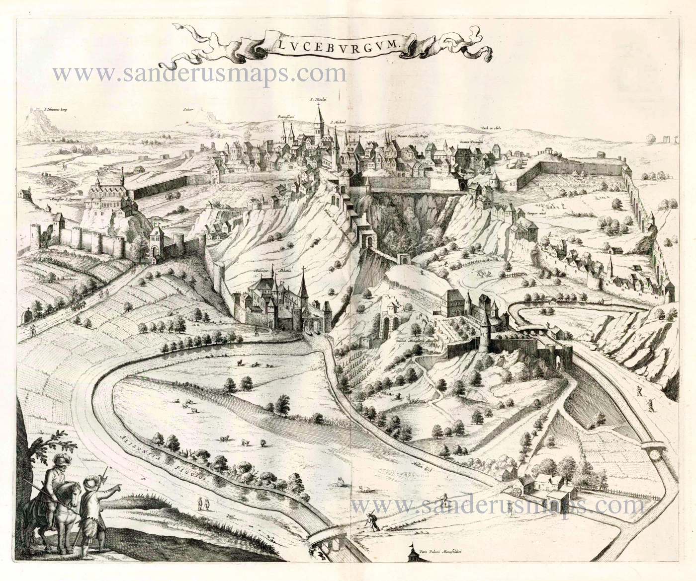
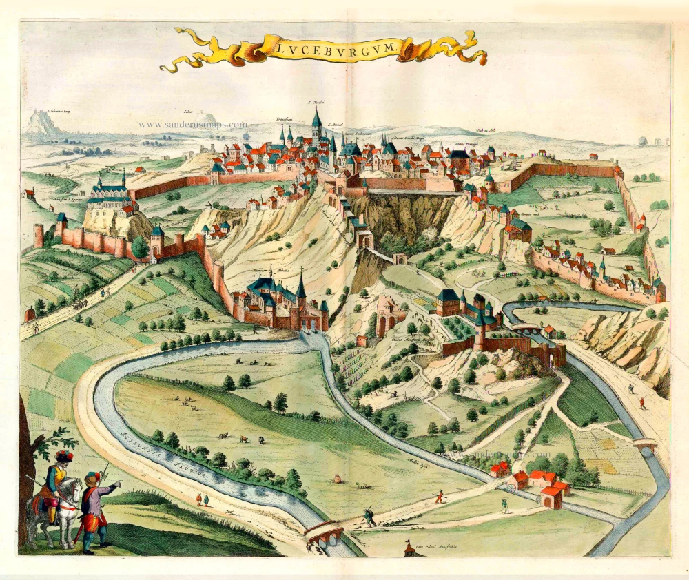
Luceburgum. 1649
Luxembourg, by Joan Blaeu.
[Item number: 105]
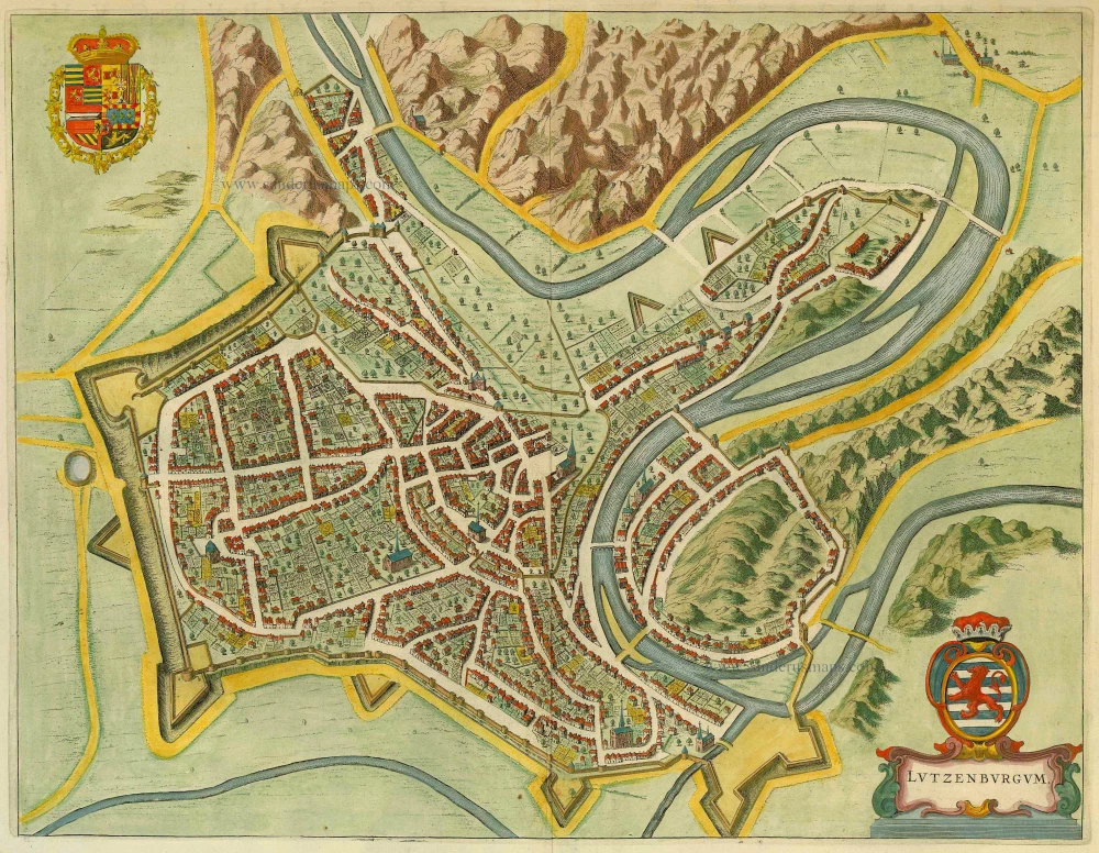
Lutzenburgum 1649
Luxembourg by Blaeu J.
[Item number: 14317]
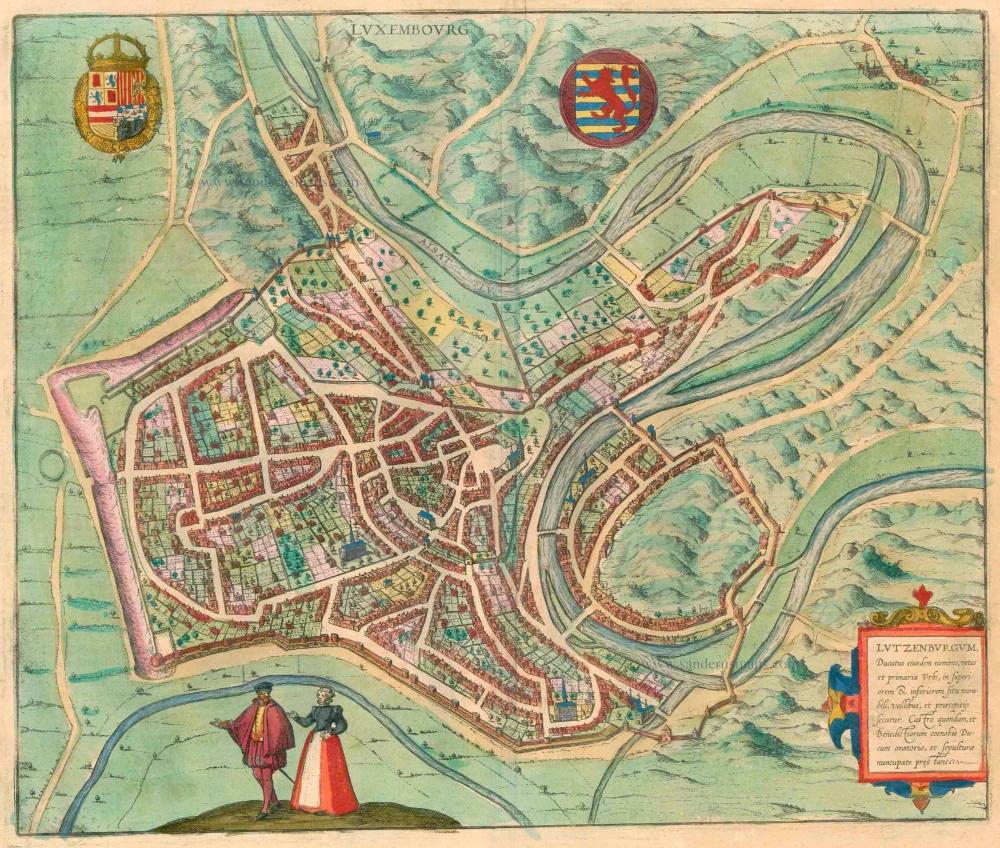
Luxembourg - Lutzenburgum, Ducatus eiusdem Nominis, Vetus et Primaria Urbs ... 1581-88
Luxembourg by Georg Braun & Frans Hogenberg
[Item number: 23308]
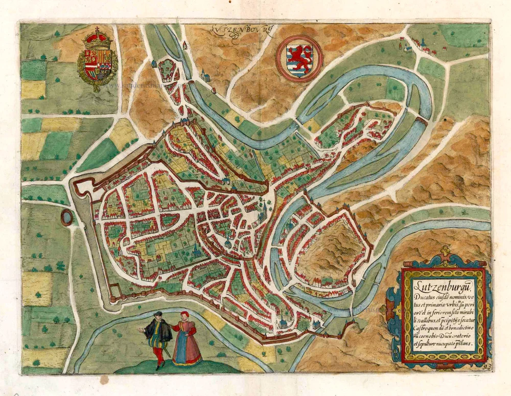
Lucenburgum Urbs eiusdem nominis Ducatus primaria et Tribunam supremum, montoso inaequali situ spectabilis. 1596-1640
Luxembourg, by Braun & Hogenberg.
[Item number: 23366]
Luceburgum. 1652
Luxembourg, by Joan Blaeu.
[Item number: 25510]
Lutzenburgu(m) Ducatus eiyusde(m) nominis, vetus et primaria urbis, ... 1609
Luxembourg, by L. Guicciardini.
[Item number: 26119]

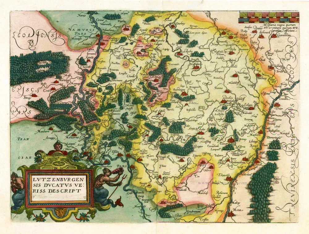
Lutzenburgensis Ducatus Veriss Descript. 1609
Luxembourg, by L. Guicciardini.
[Item number: 26219]
Lutzenburgensis Ducatus Veriss Descript. 1581
Luxembourg, by Ludovico Guicciardini.
[Item number: 26805]
Luxembourg - Lutzenburgum, Ducatus eiusdem Nominis, vetus et primaria Urbs, in superiorem & inferiorem situ mirabili, vallibus, et praecipitijs secatur. Castor quondam, et Benedictiorum coenobio Ducum oratorio, et sepulturae nuncupato prestans. 1582
Luxembourg, by Georg Braun & Frans Hogenberg.
[Item number: 28053]
Trier & Lutzenburg. 1623
Luxembourg and Trier, by Gerard Mercator.
[Item number: 28135]
Lutzenburgensis Ducatus Veriss. Descript. 1634
Luxembourg by P. Kaerius (Van den Keere), published by C.J. Visscher.
[Item number: 29610]