
World by Barent Langenes 1602
Petrus Bertius (1565-1629)
Petrus Bertius, born at Beveren, Flanders in 1565, was related with Pieter van den Keere (Kaerius) and Jodocus Hondius. Both famous cartographers were brothers-in-law of Petrus Bertius. As a refugee, he settled in Amsterdam and, after finishing his studies, he became professor of mathematics and librarian at the University of Leiden. In 1618 he also became cosmographer and historiographer to Louis XIII of France and lived in Paris, where he died in 1629.
His enormous working power resulted in many geographical and theological works. He also contributed geographic materials to the works of Clüver and Herrera.
His fame among geographers was established by his text in the pocket atlas Tabularum Geographicarum and by his edition of Ptolemy’s Geographia.
The origin of the Tabularum Geographicum lies in the well-know miniature atlas Caert thresoor, published by Barent Langenes in 1598 in Middelburg. Bertius engraved 169 maps for this small but attractive atlas which was also sold for the first time in 1599 by Cornelis Claesz in Amsterdam. In 1600, Claesz published the pocket atlas with a Latin text composed by Petrus Bertius. From then on, new editions, often enlarged with new maps, regularly appeared, subsequently published by Cornellis Claesz, Jodocus Hondius, Johannes Janssonius and ultimately, in 1649, by Claes Jansz. Visscher.
Koeman divides this series of pocketbooks into two atlases: The Caert-thresoor, published by Langenes and Claesz., with five editions between 1598 and 1609; and the Tabularum Geographicarum Contractarum by Petrus Bertius with ten editions between 1600 and 1650.
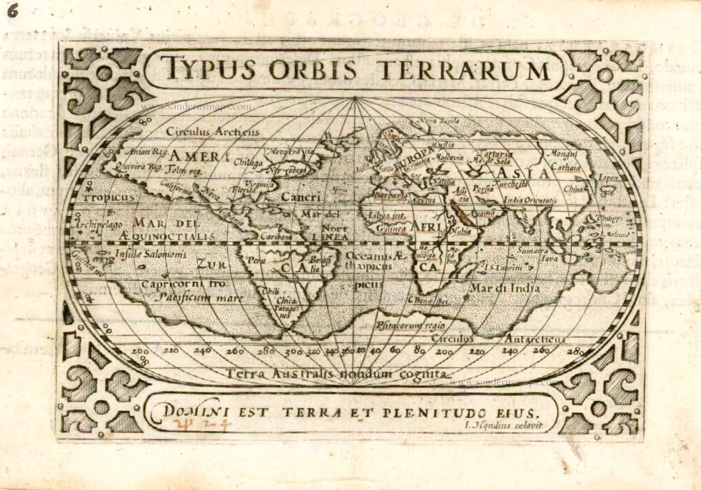
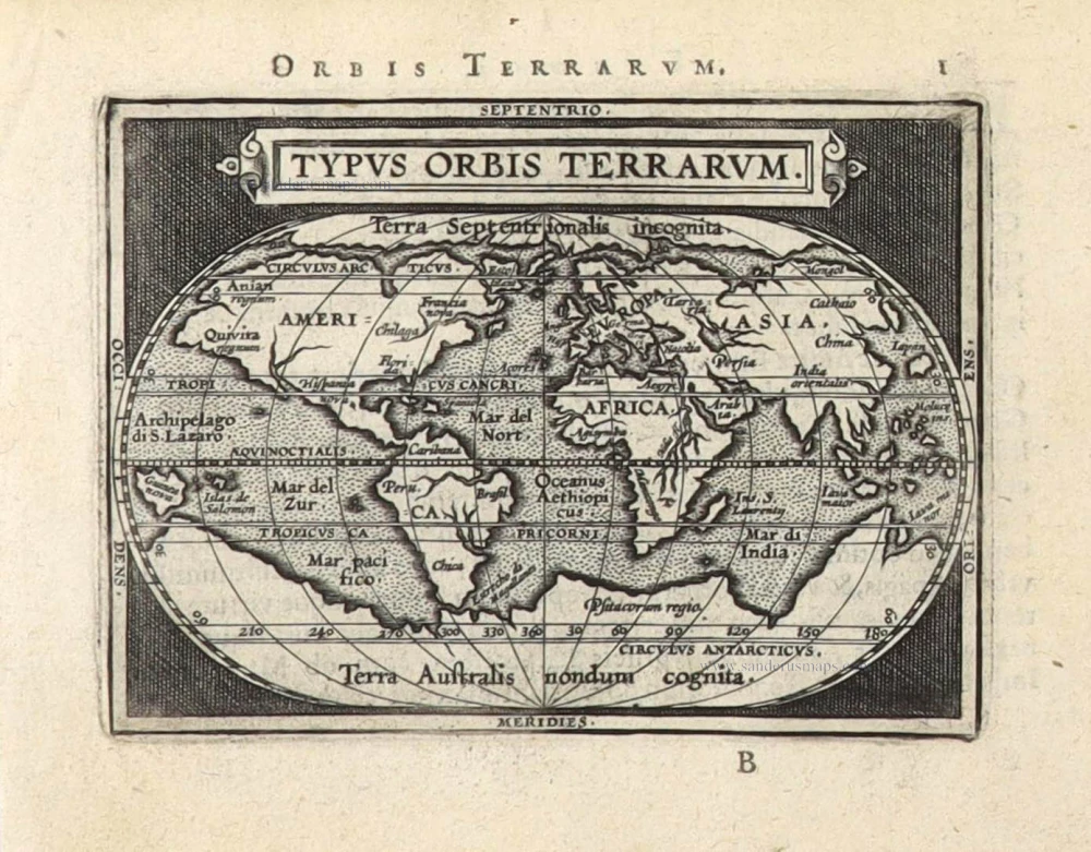
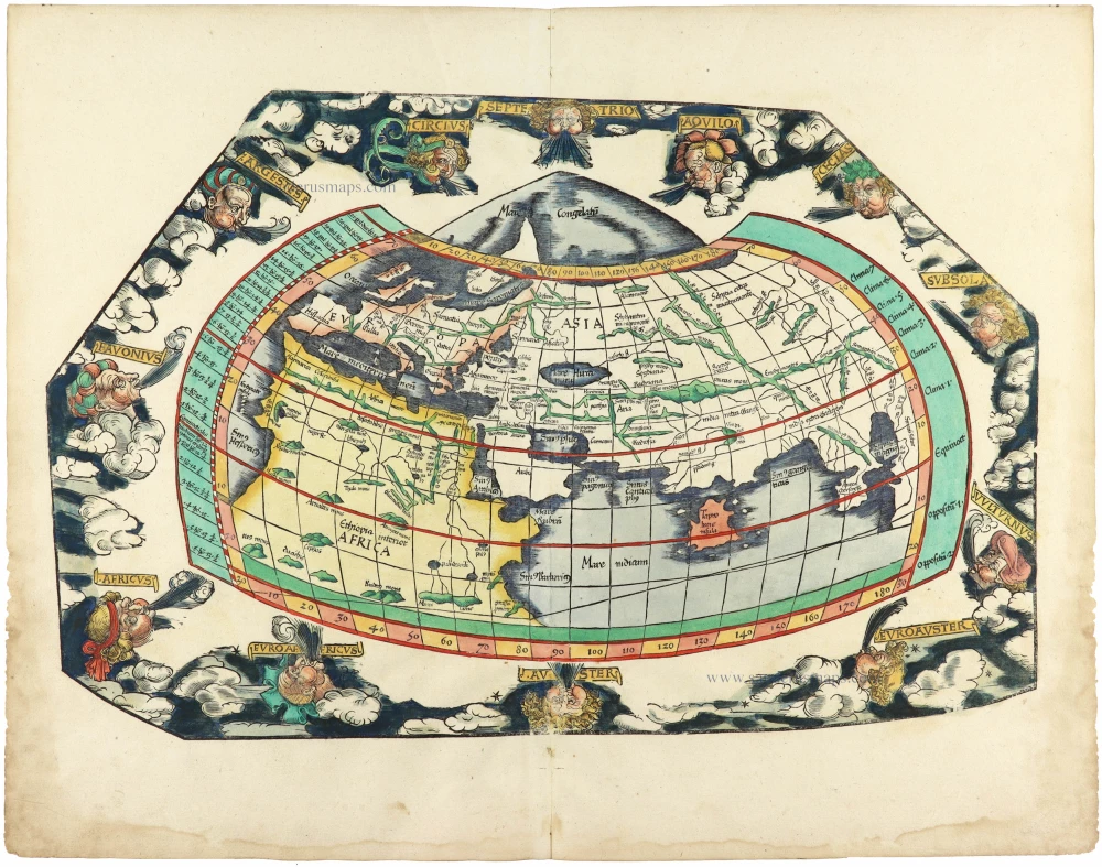
Typus Orbis Terrarum.
Item Number: 12009 Authenticity Guarantee
Category: Antique maps > World and Polar
Old antique map of the World by Langenes - P. Bertius.
Title: Typus Orbis Terrarum.
Date of the first edition: 1598.
Date of this map: 1602.
Copper engraving, printed on paper.
Size (not including margins): 95 x 137mm (3.74 x 5.39 inches).
Verso: Latin text.
Condition: Excellent.
Condition Rating: A+.
From: BERTIUS P. Tabulae Geographicae contractae, ... Amsterdam, C. Claesz., 1602/03.
Petrus Bertius (1565-1629)
Petrus Bertius, born at Beveren, Flanders in 1565, was related with Pieter van den Keere (Kaerius) and Jodocus Hondius. Both famous cartographers were brothers-in-law of Petrus Bertius. As a refugee, he settled in Amsterdam and, after finishing his studies, he became professor of mathematics and librarian at the University of Leiden. In 1618 he also became cosmographer and historiographer to Louis XIII of France and lived in Paris, where he died in 1629.
His enormous working power resulted in many geographical and theological works. He also contributed geographic materials to the works of Clüver and Herrera.
His fame among geographers was established by his text in the pocket atlas Tabularum Geographicarum and by his edition of Ptolemy’s Geographia.
The origin of the Tabularum Geographicum lies in the well-know miniature atlas Caert thresoor, published by Barent Langenes in 1598 in Middelburg. Bertius engraved 169 maps for this small but attractive atlas which was also sold for the first time in 1599 by Cornelis Claesz in Amsterdam. In 1600, Claesz published the pocket atlas with a Latin text composed by Petrus Bertius. From then on, new editions, often enlarged with new maps, regularly appeared, subsequently published by Cornellis Claesz, Jodocus Hondius, Johannes Janssonius and ultimately, in 1649, by Claes Jansz. Visscher.
Koeman divides this series of pocketbooks into two atlases: The Caert-thresoor, published by Langenes and Claesz., with five editions between 1598 and 1609; and the Tabularum Geographicarum Contractarum by Petrus Bertius with ten editions between 1600 and 1650.
Related items
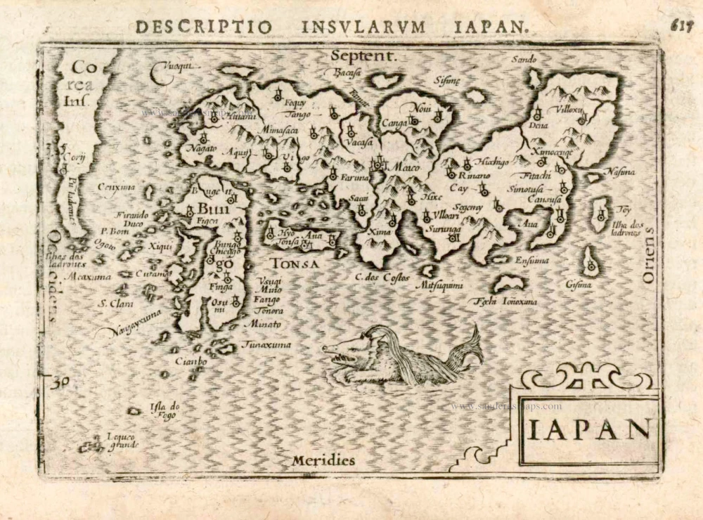
Iapan. 1602
Japan by Langenes, published by Bertius P.
[Item number: 12487]
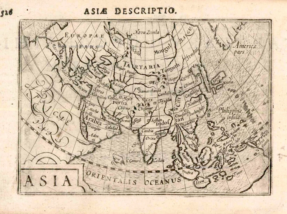
Asia 1602
Asia by Langenes, published by Bertius P.
[Item number: 12518]
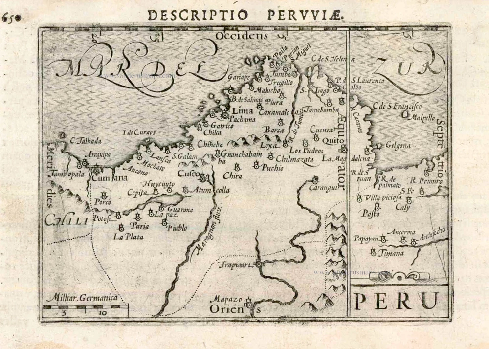
Peru 1602
Peru, by Langenes, published by Bertius P.
[Item number: 12521]

Castiliae Veteris et Novae Descriptio 1619
Old antique map of the World by A. Ortelius.
[Item number: 25590]
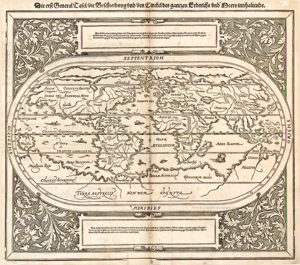
Die erst General Tafel / die Beschreibung und den Circkel des gantzen Erdtrichs und Meers innhaltende. 1588
World by Sebastian Münster.
[Item number: 25622]

Universi Orbis Descriptio. 1597
World by Giovanni Magini
[Item number: 27837]

Discorso Intorno alla Carta da Navigare. 1572
World, by Thomaso Porcacchi.
[Item number: 28015]
The most mystical world map of all time.
[No title] 1560-1600
Daniel's Dream Map. The Wittenberg world map.
[Item number: 28159]
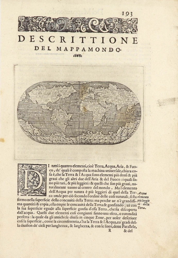
Descrittione Del Mappamondo. 1572
World by Porcacchi Tommaso.
[Item number: 28910]
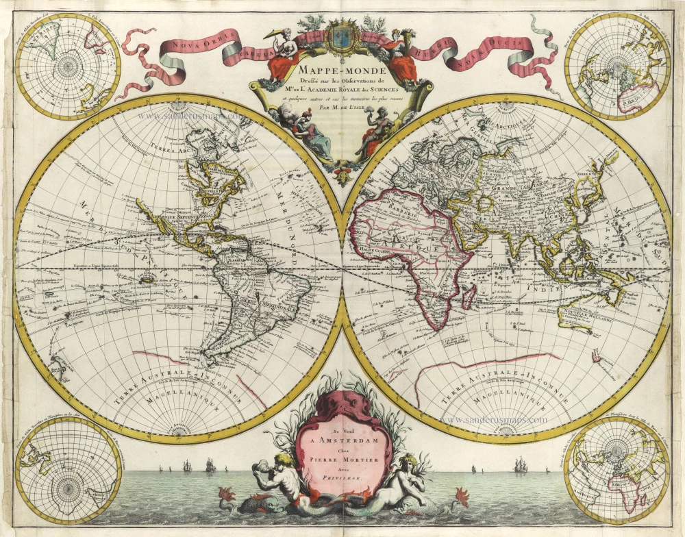
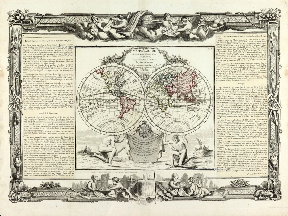
Mappe-Monde Dreßé sur les Observations de Mrs. de l'Academie Royale des Sciences et quelques autres et sur les memoires les plus recens. 1705-1711
World in two hemispheres by Pieter Mortier.
[Item number: 29509]

Mapmonde ou description generale du Globe Terrestre. 1713
World map by Zacharias Châtelain.
[Item number: 29555]
Typus Orbis Terrarum. 1589
The world by Abraham Ortelius / Philippe Galle.
[Item number: 29605]
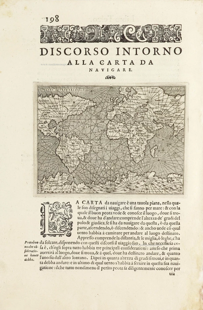
Discorso Intorno alla Carta da Navigare. 1590
World, by Thomaso Porcacchi.
[Item number: 29786]
Rare original colour.
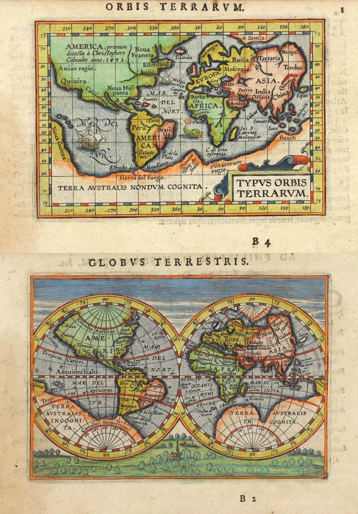
Typus Orbis Terrarum - Globus Terrestris. 1609
Two world maps by A. Ortelius, published by J.B. Vrients.
[Item number: 29861]
Mappe-Monde 1766-1780
World map by Louis Brion de la Tour, published by L.C Desnos.
[Item number: 30100]
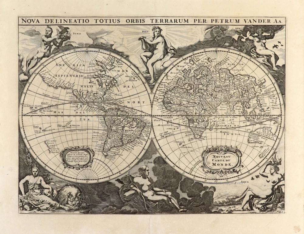
Nova Delineatio Totius Orbis Terrarum per Petrum Van der Aa. - Nouveau Carte du Monde. 1702
World by Pieter Van der Aa - double hemisphere.
[Item number: 30150]

'One of the supreme examples of map maker's art' (Shirley)
Nova Totius Terrarum Orbis Geographica ac Hydrographica. 1643
World in Mercator projection, by Willem Blaeu.
[Item number: 30271]
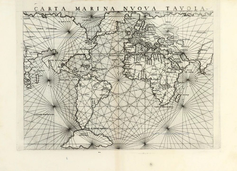
Carta Marina Nuova Tavola. 1561
World chart by Girolamo Ruscelli.
[Item number: 30380]
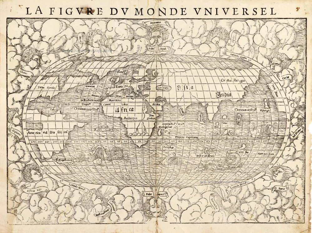
La Figure du Monde Universel 1568
Old antique map of the World by Sebastian Münster
[Item number: 30533]
First double hemisphere map.
Orbis Descriptio. 1598
World by Girolamo Ruscelli.
[Item number: 30632]
new
Rare 1525 edition in nice old colour.
[No title] 1525
Ptolemaic world by Lorenz Fries after Martin Waldseemüller.
[Item number: 30649]
new